White Sands National Monument
I did not make it to White Sands until 5:30 p.m. or so on Day 40; and I knew I had to climb in elevation again to camp. It was a less severe (but still uncampable) 102 degrees. The park is very cool. The combination of the storming sunset, white sands, blackish mountains, and hooded picnic benches made the picnic area look like an alien gathering on another planet.
 I
ended up camping even higher in Lincoln National Forest, although it
was still in the 70s at night. There is no front country campground in
White Sands even if I wanted to stay. It would be fun to backpack here
in the winter when the temperature is a little more reasonable. I would
bet I could shoot some much better photos if I could get back into the untouched dunes.
I
ended up camping even higher in Lincoln National Forest, although it
was still in the 70s at night. There is no front country campground in
White Sands even if I wanted to stay. It would be fun to backpack here
in the winter when the temperature is a little more reasonable. I would
bet I could shoot some much better photos if I could get back into the untouched dunes.Guadalupe Mountains National Park
I reached Guadalupe in good time on Day 41. I set up camp at a site which will certainly compete for top campsite. Afterwards, I set out to hike for a bit.
 GMNP is one of those parks that does not have many miles of roads within its boundaries. Like Canyonlands and other parks I have mentioned, the reason most visitors come to it is for its backcountry camping and day hiking. Unfortunately for me, it was about 95 degrees during mid-day, much to hot to enjoy hiking. So I hiked one of the popular trails. But the cool thing about popular trails in the off-season is they aren't crowded (I was the only one on this trail).
 The park seasons is another funny thing. Its best contrast is probably between Death Valley and Yosemite. When one is at the height of its tourism, the other is at its lowest point. This was the case all through the Southwest. While it was nice to be there with relatively few people, I wanted to get out - it was just too hot for too many days in a row. More to come on this.
The hike I completed was based around springs from the mountains. The desert and the majority of the mountains were bone dry, even though I was there during rainy season. But the funny thing is, as dry as it was, if I only showed you this, this and this would you have guessed I was in the middle of a vast and scorching emptiness?
Carlsbad Caverns National Park
Carlsbad Caverns NP is within 50 miles of GMNP, although they are in different states. I wanted to do some relaxing these two days, so I decided to keep camp at GMNP and visit Carlsbad for the day and come back. I did this on my second day at GMNP, Day 42.
 I've been to other caves before, but I was excited for this cave because I knew they had self-guided tours (free with my pass). But this has to be one of the worst entrance setups I have seen. My car was about 100 yards from the visitor center entrance. Here's what I did.
I packed up my day pack with water and snacks and some emergency items. I walked to the visitor center. I read, on the outside of the door in a font perhaps larger than the No Parking sign at Canyonlands NP, "NO FOOD OR DRINK IN THE VISITOR CENTER." I returned to my car to put the pack with the food and drink away. I returned to the visitor center, asked a ranger for a map and returned to the car with my pack. I read on the map no food was allowed in the cave, so I put my food in the car and grabbed the pack. Then I walked around the visitor center looking for a place to enter the cave. I couldn't find it. I returned my pack to my car and went back in the visitor center. I waited in line for a ride down the elevator into the cave. I was told, when I reached the front of the line, that I needed a ticket for the self-guided tour. So I stood in line for a ticket. I got my ticket and went back to the elevator line. Then I read on a board near the elevator we were allowed water in the cave. So I went back to my car, decided I had to break one of their so-called rules and take water into the visitor center (unless water doesn't count as drink). Then I waited in line for the elevator again.
 And I made it in the cave no less than an hour later!
It was a really fun hike. I combined the two trails to make a good workout. Unfortunately, it's very difficult to photograph caves. I have a few that turned out well with a tripod and without a flash. This is my favorite. They also had a gift shop in the cave.
The room where the vast majority of these photos are taken is the seventh largest cave room in the world; it's a little more than 8 acres.
The most popular route to take is to climb down the natural entrance and take the elevator up. I wanted a workout so I did it the other way. Do you remember me talking about the Bryce Canyon hike via Navajo Loop? If so, this was just as steep, but 2.5 times longer. It was quite a climb, but it felt great!
One of the main attractions to Carlsbad Caverns is the batflights at sunset. I wanted to get back to camp before sunset (to make dinner in the light), so I did not hang around.
Big Bend National Park
Day 43 was spent driving to and visiting Big Bend National Park in Southwestern Texas, or as the brilliant residents of Texas would say, "Wast Taxes." So now that I'm in to discussing Texans, I should take an aside.
The Brilliancy of Texans
To my one and only friend from Texas: You may be exempt from these harsh remarks. You clearly don't fit in with these people. And later, when I talk about Kentucky, you may be exempt from those as well. It's a simple coincidence you picked the two most-specialist states to reside within.
I was driving on a road which was going back-and-forth between being a divided and undivided highway. To begin a divided highway in the United States requires a sign - a caution sign nonetheless. This is what it looks like:

Or, if you can't figure out what that picture means, you may use this:

When the divided highway ends, this sign is usually used:
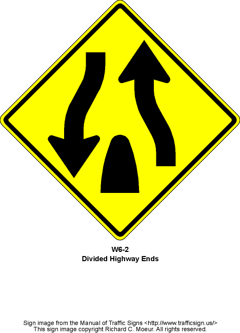
Of course, you could substitute the words, assuming you know how to spell. At one point in Texas, I entered a divided highway to the sign with the symbol for Divided Highway Ends. I simply thought to myself, I suppose people can make really big mistakes at work. I passed it off as not too important, but made a note to look at the sign when the divided highway ends. And sure enough, they used the wrong sign again!
Before I leave my aside, I want to tell you of another funny construction incident. Somewhere in Colorado I saw a funny sign. I'm sure you've seen the construction slogan, Give 'Em A Brake! at some point in your driving. Why they can't write Them I have no idea. Yet, I still find the slogan clever. But this is America - it clearly goes over one out of every three peoples' heads. Which is why the sign in Colorado said, Give 'Em A Break! I'm pretty sure they already have breaks scheduled into their daily routine, and I don't want to give them any more.
Back to Big Bend
I entered Big Bend late morning. The drive there was not all that exciting. When you enter the park from the north, it's on a straight road with a 55 mph speed limit. When you get into the park, the speed limit goes down to 45 mph but nothing changes. And you aren't into the mountains for 30+ miles. So it's another 45 minutes of boring driving. I think it's fine the northern boundary is so far from the mountains, but that should affect the speed limit of a straight, flat road.
 I decided to try to find a campsite first and then explore. The campground I tried for was in a little basin and turned out to be one of the coolest sites at which I've stayed. That photo doesn't show everything - the panoramic will be better when it's ready. But if you picture a mountain like that on nearly every side of the site, you'll get the picture.
Within a couple minutes of picking out the site, the camp host comes by and says, "So we just saw a mama bear and two cubs in this area last night. Also, we have skunks. Oh yeah, and this little loop was closed last week because of an aggressive [mountain] lion." I asked him if they'd caught the lion. He told me they had not. "I just wanted to let you know," he said, clearly meaning, "I just wanted to scare you silly." I tried to put it out of my mind, but I couldn't. It tainted the rest of the day.
 The park itself is very big, and I knew I couldn't visit it all in one day, so I tried for the best part. I decided upon the scenic drive, considering the temperature (still well above 100 degrees in mid-afternoon). But the drive was beautiful. And I got to stand in Rio Grande! I did not cross over into Mexico and therefore did not go to jail. What surprised me was the temperature of the water. It was hot! It is, after all, from snow melt in the Rocky Mountains. Therefore, I did not swim.
The drive was beautiful and I would definitely return to the park to see more of it. Unfortunately, it was just too hot to do much. And, as I've mentioned, I'd been in the desert for awhile; I was ready to leave. I was tired of being hot and just wanted a little rain. So I was excited to leave. On Day 44 I packed up early and set out for an 800-mile drive to Hot Springs, Arkansas.
Texas & New Mexico Album
Next Post: Oklahoma, Arkansas & Louisiana.
No comments:
Post a Comment