I rushed the last four posts and therefore probably left some things out. I hope you are able to enjoy my stories anyways (and and please forgive my misspellings and grammatical errors). What I may have left out, you may deduct from my photos (since this is how we know water formed the badlands).
I have taken photos for several panoramic combinations. However, because I do not have Photoshop, these will have to wait. When I am able to complete these, I'll present them in a new post.
Thanks again for reading!
7.30.2011
Wyoming, Round 2
Welcome to the last post for today. The entrance into Wyoming via the Beartooth Highway (which winds back and forth between Montana and Wyoming) did mark a new state. Still at 20. But this will be changing today with the fabulous...drum roll, please...Nebraska!
Yellowstone National Park
Like Glacier, you've heard many of my thoughts on Yellowstone. And like Glacier, they were in the off-season, compared to now, the height of tourist season. I returned to Yellowstone for two reasons: 1) I wanted to go back to Glacier and it was on the way, and 2) I wanted to give Grand Teton National Park a fair chance (I had driven through twice but never stopped). My purpose in Yellowstone this time was to get down to the Geyser Basin (which I missed earlier this summer) and try to get some good photos.
I arrived early to fight for a campsite. I was twice recommended Tower Falls, and when I got there I couldn't believe it - it competes with the worst sites I've stayed at so far. I still have no idea why it was recommended. It was wide open - no privacy - small, hilly and without a view. But it was a site in the park.
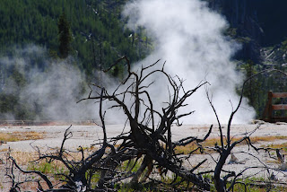 So I set up camp and headed for the geyser basin. I don't have any one photo to pull out for you. I liked many of those I took here.
As far as tourism goes, it was packed; but at least this time I expected it. I called it A Wednesday Wal-Mart Crowd (band name?). Here's my favorite person. Oh, and probably my favorite photo from one of the boardwalks.
Where I distinguish visitors from tourists is mostly in the concept of following rules, be it stopping next to a Don't Stop For The Next 1/2 Mile sign, approaching wildlife, driving 20 mph in a 45 mph zone and not pulling off at a turnout. Those are the obvious ones, but my favorite was the woman at my campsite. She used the toilet (i.e. four stone walls, a door and a pit) and walked outside. Now, I fault Yellowstone for putting a water pump near the bathroom, but here's her story.
A woman leaves the toilet room at Tower Falls campground. She noticed the hand sanitizer on the wall, but purposefully bypassed it because of the funny way the alcohol feels on her dry hands. She sees a faucet! Wow, she thinks. She approaches the faucet and reads the sign. The sign reads, Please do not use faucet for dish washing, bathing or brushing teeth. Thank You. She thinks, Hmmm, I'm not sure washing hands is technically "bathing." She looks around. She washes her hands. She leaves. Five minutes later she returns with a spoon and washes it under the faucet
On the drive back to camp that day, I saw a grizzly bear running around in a field. He was far away, but I liked the photo and enjoyed watching him for a bit. I also saw a bunch of buffalo, both in the Hayden Valley and the Lamar Valley. But while these herds dwarfed those in Theodore Roosevelt NP, there was no way I'd beat the backdrop of the bad lands (unless the buffalo were to be hanging around the hot springs, which they weren't), so I didn't take many photos. On the other hand, people would stop in the middle of the road to view one buffalo. I would think to myself, I bet if once you make this turn up ahead, you'll see hundreds more. It was always the case.
 Again I skipped Old Faithful. You've got to see it one day. But once you've seen it once, you've seen it. And once you've taken a photo of it with your $10 camera, you've got your photo (unless some wildlife happen to be hanging around).
Grand Teton National Park
The plan for Day 13 was to drive back through Yellowstone and visit Grand Teton NP. Since I was in the northeast corner of the gigantic park, I knew I had a healthy drive in front of me. I got going around 9 a.m. This turned out to be a good time to leave.
I turned out of the campground and was immediately slowed by a van going 20 mph below the speed limit. Already frustrated, I passed the van. The stretch of road between Tower and Canyon are beautiful, and this week they displayed a vast landscape of wildflowers - gorgeous! I wasn't going to stop, but decided I should simply to be able to supplement my telling of the beauty to you with a photo (a photo that really doesn't do it justice). For some reason I decided to take out my zoom lens and take a few more photos. I didn't need it and I don't know why I took it out. When I got back in the car, I thought, I should put the regular lens back on for my photos of the lake on the way out. Well, maybe I'll see some wildlife, so I'll leave it on for now.
A few miles later I see a ranger's truck up ahead with its lights on. Immediately thought, Why am I going to get stopped this t-
 My thought was interrupted by a grizzly bear passing in front of the ranger's truck (I like the 100 feet measurement), not 100 feet from my car. The bear then went up the hill, and turned and walked on the hill in the direction of my car. I rolled my window down and shot some photos, all the while thinking, Please don't smell my food and come running in here. Here he is. That made my day! Had I done anything different, I would have missed him. Fortunately, I didn't notice this earlier, but when I was reviewing my photos last night I noticed the grizzly was wearing something around its neck. This shows up in every photo except that first one, and I'm glad I have one good one! I'm guessing the rangers had captured the bear and put this device on him to track him, letting him go just before I approached. In any respect, wildlife is wildlife and I saw a grizzly up close!
I continued on the road, intuition working subconsciously in my favor. I passed hundreds of buffalo and thought I should at least get one good photo for my wonderful girlfriend, who loves buffalo second only to penguins. As I was turning to get back into my car I saw something move on a far off hill. Deer? Maybe. Zoom lens was still ready so I took a look. Coyote! But he disappeared. So I moved onto the next pullout.
Several people were at this pullout off to the right photographing ducks or something (that's cool). I kept looking to the left, hoping I'd see him. Sure enough, I found him sitting on the hillside. Then he began to move down the hill and in front of a lake, where he would stick his nose in the ground, looking for something, and then come up chewing.
What great timing on all of this. In other wildlife news, I spotted a hippie circle.
Finally, I entered Grand Teton NP. I feel bad (maybe not the right emotion) that GTNP is located where it is. It is figuratively dwarfed by Yellowstone and therefore really only serves as a drive-through park. If it were located anywhere else (not bordering a major park or city), it would certainly be a destination park and would probably also be much less crowded. It's truly fascinating. It's similar to Glacier except much taller. There is a huge valley through which the main road runs around 6,000 feet in elevation and then BOOM, mountains 13,000+ feet tall out of nowhere! But it somehow doesn't compare to Glacier. Maybe it's the valley is too large and without much vegetation, maybe it's the limitation of really only one viewpoint of the mountain, maybe it's that the road doesn't go through the mountain, or maybe it's that the hikes are on the mountains instead of in between the mountains. Whatever it is, it doesn't compare.
 I set up camp and did a hike to Hidden Falls and Inspiration Point. This hike is 6 miles total and it too was filled with tourists! Most people set out for this six mile hike with their 1) tennis shoes, 2) plastic, disposable, 20-ounce Dasani water bottle and 3) handheld camera. One 8-year-old boy actually started the walk and said, "Mom, mom, mom, I forgot my phone in the car."Me? I was ready to go again. Five liters of water, some food, tripod and bag that disguises me as a real photographer. Oh yes, bear bell and bear spray.
In this book I've talked about (10 Best), there is a section on Best Places To Say "I Do" Or "I Will." One of these was Inspiration Point in GTNP.
Inspiration Point sucks. Hey, look how high I am and that really flat land and those foothills. I bet the mountain behind me is beautiful, though. Hidden Falls was cool, but the extra mile to climb up to that point is worthless. Aside from the hundred other people standing around you, who in their right mind would propose there (clarification to one reader)? It was great to get out and get the legs moving for three hours, but hiking in the Tetons isn't that great because you're hiking where you want to be looking while you're hiking.
On my walk back I saw a 14-year-old girl by herself. I said, "Hi." Oh, this reminds me. Saying "Hi" to people on the trail is funny. When you're in the backcountry, everyone greets everyone else excitedly. In these tourist spots, hardly anyone talks to people outside their group. I passed two teenage boys on the trail. I said "Hey guys." One of them responded, "Grmph" (or however you spell a grunt).
So I greet this girl and she responds with a smile. Then I see this guy jogging up my way. He says, "Have you seen a little girl up here?" I said, "Sure, she's back there sitting on a rock." He then explains to me (after yelling at the girl) that he just saw a black bear about four feet tall (when on all fours). He said the bear came out of the woods and turned on the trail in my direction. I never saw this bear because it was beyond a blind corner for me, but I am convinced the bear moved back into the woods because he heard my bell! I just think what would have happened it someone else would have been walking that corner and not making noise.
I reported the sighting to the ranger later. He said, "Yeah, we've had reports of a bear in that area earlier this morning," nonchalantly.
Day 14
The next day I drove to Jenny Lake to get a good panoramic with the sun in its right spot. Just as I was pulling over, this guy, out of his truck, says, "There's a bear right here!" I look over and there is a black bear literally on the other side of his truck! Why he was out of his truck, I have no idea. This time, though, I didn't have the zoom lens ready and never got a photo of him before he went back into the woods.
8 Bears in Leg 2.
I left the park that day and headed to where I am now. US-287 was a beautiful drive and will surely compete for the Top 10 list. Another short post and then I'll see you all in a couple weeks. I am planning to stay at a KOA in the Las Vegas area at that time.
Wyoming Album
Yellowstone National Park
Like Glacier, you've heard many of my thoughts on Yellowstone. And like Glacier, they were in the off-season, compared to now, the height of tourist season. I returned to Yellowstone for two reasons: 1) I wanted to go back to Glacier and it was on the way, and 2) I wanted to give Grand Teton National Park a fair chance (I had driven through twice but never stopped). My purpose in Yellowstone this time was to get down to the Geyser Basin (which I missed earlier this summer) and try to get some good photos.
I arrived early to fight for a campsite. I was twice recommended Tower Falls, and when I got there I couldn't believe it - it competes with the worst sites I've stayed at so far. I still have no idea why it was recommended. It was wide open - no privacy - small, hilly and without a view. But it was a site in the park.
So I set up camp and headed for the geyser basin. I don't have any one photo to pull out for you. I liked many of those I took here.As far as tourism goes, it was packed; but at least this time I expected it. I called it A Wednesday Wal-Mart Crowd (band name?). Here's my favorite person. Oh, and probably my favorite photo from one of the boardwalks.
Where I distinguish visitors from tourists is mostly in the concept of following rules, be it stopping next to a Don't Stop For The Next 1/2 Mile sign, approaching wildlife, driving 20 mph in a 45 mph zone and not pulling off at a turnout. Those are the obvious ones, but my favorite was the woman at my campsite. She used the toilet (i.e. four stone walls, a door and a pit) and walked outside. Now, I fault Yellowstone for putting a water pump near the bathroom, but here's her story.
A woman leaves the toilet room at Tower Falls campground. She noticed the hand sanitizer on the wall, but purposefully bypassed it because of the funny way the alcohol feels on her dry hands. She sees a faucet! Wow, she thinks. She approaches the faucet and reads the sign. The sign reads, Please do not use faucet for dish washing, bathing or brushing teeth. Thank You. She thinks, Hmmm, I'm not sure washing hands is technically "bathing." She looks around. She washes her hands. She leaves. Five minutes later she returns with a spoon and washes it under the faucet
On the drive back to camp that day, I saw a grizzly bear running around in a field. He was far away, but I liked the photo and enjoyed watching him for a bit. I also saw a bunch of buffalo, both in the Hayden Valley and the Lamar Valley. But while these herds dwarfed those in Theodore Roosevelt NP, there was no way I'd beat the backdrop of the bad lands (unless the buffalo were to be hanging around the hot springs, which they weren't), so I didn't take many photos. On the other hand, people would stop in the middle of the road to view one buffalo. I would think to myself, I bet if once you make this turn up ahead, you'll see hundreds more. It was always the case.
Again I skipped Old Faithful. You've got to see it one day. But once you've seen it once, you've seen it. And once you've taken a photo of it with your $10 camera, you've got your photo (unless some wildlife happen to be hanging around).Grand Teton National Park
The plan for Day 13 was to drive back through Yellowstone and visit Grand Teton NP. Since I was in the northeast corner of the gigantic park, I knew I had a healthy drive in front of me. I got going around 9 a.m. This turned out to be a good time to leave.
I turned out of the campground and was immediately slowed by a van going 20 mph below the speed limit. Already frustrated, I passed the van. The stretch of road between Tower and Canyon are beautiful, and this week they displayed a vast landscape of wildflowers - gorgeous! I wasn't going to stop, but decided I should simply to be able to supplement my telling of the beauty to you with a photo (a photo that really doesn't do it justice). For some reason I decided to take out my zoom lens and take a few more photos. I didn't need it and I don't know why I took it out. When I got back in the car, I thought, I should put the regular lens back on for my photos of the lake on the way out. Well, maybe I'll see some wildlife, so I'll leave it on for now.
A few miles later I see a ranger's truck up ahead with its lights on. Immediately thought, Why am I going to get stopped this t-
My thought was interrupted by a grizzly bear passing in front of the ranger's truck (I like the 100 feet measurement), not 100 feet from my car. The bear then went up the hill, and turned and walked on the hill in the direction of my car. I rolled my window down and shot some photos, all the while thinking, Please don't smell my food and come running in here. Here he is. That made my day! Had I done anything different, I would have missed him. Fortunately, I didn't notice this earlier, but when I was reviewing my photos last night I noticed the grizzly was wearing something around its neck. This shows up in every photo except that first one, and I'm glad I have one good one! I'm guessing the rangers had captured the bear and put this device on him to track him, letting him go just before I approached. In any respect, wildlife is wildlife and I saw a grizzly up close!I continued on the road, intuition working subconsciously in my favor. I passed hundreds of buffalo and thought I should at least get one good photo for my wonderful girlfriend, who loves buffalo second only to penguins. As I was turning to get back into my car I saw something move on a far off hill. Deer? Maybe. Zoom lens was still ready so I took a look. Coyote! But he disappeared. So I moved onto the next pullout.
Several people were at this pullout off to the right photographing ducks or something (that's cool). I kept looking to the left, hoping I'd see him. Sure enough, I found him sitting on the hillside. Then he began to move down the hill and in front of a lake, where he would stick his nose in the ground, looking for something, and then come up chewing.
What great timing on all of this. In other wildlife news, I spotted a hippie circle.
Finally, I entered Grand Teton NP. I feel bad (maybe not the right emotion) that GTNP is located where it is. It is figuratively dwarfed by Yellowstone and therefore really only serves as a drive-through park. If it were located anywhere else (not bordering a major park or city), it would certainly be a destination park and would probably also be much less crowded. It's truly fascinating. It's similar to Glacier except much taller. There is a huge valley through which the main road runs around 6,000 feet in elevation and then BOOM, mountains 13,000+ feet tall out of nowhere! But it somehow doesn't compare to Glacier. Maybe it's the valley is too large and without much vegetation, maybe it's the limitation of really only one viewpoint of the mountain, maybe it's that the road doesn't go through the mountain, or maybe it's that the hikes are on the mountains instead of in between the mountains. Whatever it is, it doesn't compare.
I set up camp and did a hike to Hidden Falls and Inspiration Point. This hike is 6 miles total and it too was filled with tourists! Most people set out for this six mile hike with their 1) tennis shoes, 2) plastic, disposable, 20-ounce Dasani water bottle and 3) handheld camera. One 8-year-old boy actually started the walk and said, "Mom, mom, mom, I forgot my phone in the car."Me? I was ready to go again. Five liters of water, some food, tripod and bag that disguises me as a real photographer. Oh yes, bear bell and bear spray.In this book I've talked about (10 Best), there is a section on Best Places To Say "I Do" Or "I Will." One of these was Inspiration Point in GTNP.
Inspiration Point sucks. Hey, look how high I am and that really flat land and those foothills. I bet the mountain behind me is beautiful, though. Hidden Falls was cool, but the extra mile to climb up to that point is worthless. Aside from the hundred other people standing around you, who in their right mind would propose there (clarification to one reader)? It was great to get out and get the legs moving for three hours, but hiking in the Tetons isn't that great because you're hiking where you want to be looking while you're hiking.
On my walk back I saw a 14-year-old girl by herself. I said, "Hi." Oh, this reminds me. Saying "Hi" to people on the trail is funny. When you're in the backcountry, everyone greets everyone else excitedly. In these tourist spots, hardly anyone talks to people outside their group. I passed two teenage boys on the trail. I said "Hey guys." One of them responded, "Grmph" (or however you spell a grunt).
So I greet this girl and she responds with a smile. Then I see this guy jogging up my way. He says, "Have you seen a little girl up here?" I said, "Sure, she's back there sitting on a rock." He then explains to me (after yelling at the girl) that he just saw a black bear about four feet tall (when on all fours). He said the bear came out of the woods and turned on the trail in my direction. I never saw this bear because it was beyond a blind corner for me, but I am convinced the bear moved back into the woods because he heard my bell! I just think what would have happened it someone else would have been walking that corner and not making noise.
I reported the sighting to the ranger later. He said, "Yeah, we've had reports of a bear in that area earlier this morning," nonchalantly.
Day 14
The next day I drove to Jenny Lake to get a good panoramic with the sun in its right spot. Just as I was pulling over, this guy, out of his truck, says, "There's a bear right here!" I look over and there is a black bear literally on the other side of his truck! Why he was out of his truck, I have no idea. This time, though, I didn't have the zoom lens ready and never got a photo of him before he went back into the woods.
8 Bears in Leg 2.
I left the park that day and headed to where I am now. US-287 was a beautiful drive and will surely compete for the Top 10 list. Another short post and then I'll see you all in a couple weeks. I am planning to stay at a KOA in the Las Vegas area at that time.
Wyoming Album
Montana, Round 2
Day 8 was a long day as I headed toward Glacier for the second time this summer. I've shared many of my thoughts of Glacier and Montana in the post earlier this summer. I'll only focus on what was different.
The Drive
The drive was certainly different. Instead of driving between mountains most of the way, I was in the rolling hills. And yes, the sky is gigantic.
 The drive into the park is no less amazing when you know what to expect. It's still a shock, and it's still phenomenal. I would definitely recommend entering from the east side, for the views seem much more sudden.
The Tourists
I find there to be a great difference between park visitors and park tourists. I was going to spend a whole post on this. Instead of being negative, I decided I'll just share my funny tourist stories with you.
Tourists were a big difference this time around. The park was packed! I arrived around 6 p.m. on Saturday and there were no camping spots left. You're probably thinking, Well, it's Saturday, duh! Sure, but last time, we arrived on a Saturday at 7 p.m., when there were fewer campgrounds open, and we walked right in. I found a place on the east side of the park. I also later found out, if you're in jeopardy of not getting a spot in the park, you probably want to enter from the west side, which is way more touristy (the east side is an Indian Reservation).
Day 9
 The next day I got up early and grabbed a campsite at Rising Sun. I then drove out of the park and up to Many Glacier, where I did a hike around the lake. Beforehand I got me a bear bell and some bear spray for the reasonable price of $58.85. As one Nashville hiker may say, "Well, meh, it's a $50 life insurance policy."
The trail was nice, beautiful in fact. Although you'll find photos from the hike in the album, I wasn't pleased with any of them. This time around I really wanted to experience the Going-To-The-Sun Road and try to get some different photos. These didn't feel different to me.
Nevertheless, the day was gorgeous and the hike extremely fun. On the way out I saw a black bear and its three cubs. I italicize "saw" because I really could only see the female. I bought a 300mm zoom lens; but they were so far away, I really couldn't make out the cubs. Maybe you can? Anyways, that's 4 bears!
Day 10
I saved the Going-To-The-Sun Road for the day I had more time. And just to my luck, it was overcast that morning! So I decided to drive the road most of the way and then work my way back slowly, hoping the weather may break. I found a nice little spot on Lake McDonald to play guitar and mess around with the camera.
 Of course, it started raining, so I left and moved back east. And I'm not kidding you, five minutes after I left that spot there wasn't a cloud in the sky. So I went back and got a few good pictures.
On the way back I stopped to hike the Hidden Lake Nature Trail, because my bible told me it was a good idea. This is where I really started to get frustrated with tourists. This trail was 3 miles total, half of it uphill, and it was littered with tourists! From this photo you can see how it goes up and winds around the mountain. The whole time I was wondering why there were so many people. I later read the trail is a boardwalk all the way to the top. We just couldn't see it because of the snow. I, of course, was prepared with my synthetic pants, day pack, 5 liters of water, bear bell and bear spray. Not everyone was so much so. Most had shorts and tennis shoes on. Look for the girl in this photo. And check out this guy in his camo gear.
Even with all the people, the hike was rewarding. There was a small lake near the top (not Hidden Lake) along with a bunch of mountain goats. I took a lot of photos of the goats, and many of them turned out well, so I included most of them in the album.
Day 11
I left the park the next day and headed toward Yellowstone. I went back through the Going-To-The-Sun Road and left from the west side. This was a huge mistake. Not only was it cloudy, but taking adding the US-93 route (dotted on the map, but not worth it) added an extra 3+ hours to the trip.
The good story I have from this is I was in a cloud. My friend (I'll call her Heather) will be jealous!
A Note On Lists
I mentioned the 10 Best book in my last post. This got me thinking about making my own lists, for this book is just one collective opinion. I've decided I am going to close this blog at the end of my trip with some lists (similar to what I did after Leg 1). One such list will be Best Drives. The Going-To-The-Sun Road will most likely make this list.
The Beartooth Highway
I was speaking with my father about this list idea on Day 11 and he insisted I go out of my way to enter Yellowstone via the Beartooth Highway. As a result, I camped at the beginning of the highway in Custer National Forest to drive the highway in the morning.
 The morning of Day 12 I drove this road. Before doing so, I spoke with the camp hosts about the drive. They said a couple from Austria visited them last summer and called the road The most beautiful road they had ever driven on, and apparently they had been all over the world. They road certainly is spectacular, and it's worth a trip. But I will save my judgements until summer's end.
The Montana Album
Next Post: Wyoming
The Drive
The drive was certainly different. Instead of driving between mountains most of the way, I was in the rolling hills. And yes, the sky is gigantic.
The drive into the park is no less amazing when you know what to expect. It's still a shock, and it's still phenomenal. I would definitely recommend entering from the east side, for the views seem much more sudden. The Tourists
I find there to be a great difference between park visitors and park tourists. I was going to spend a whole post on this. Instead of being negative, I decided I'll just share my funny tourist stories with you.
Tourists were a big difference this time around. The park was packed! I arrived around 6 p.m. on Saturday and there were no camping spots left. You're probably thinking, Well, it's Saturday, duh! Sure, but last time, we arrived on a Saturday at 7 p.m., when there were fewer campgrounds open, and we walked right in. I found a place on the east side of the park. I also later found out, if you're in jeopardy of not getting a spot in the park, you probably want to enter from the west side, which is way more touristy (the east side is an Indian Reservation).
Day 9
The next day I got up early and grabbed a campsite at Rising Sun. I then drove out of the park and up to Many Glacier, where I did a hike around the lake. Beforehand I got me a bear bell and some bear spray for the reasonable price of $58.85. As one Nashville hiker may say, "Well, meh, it's a $50 life insurance policy."The trail was nice, beautiful in fact. Although you'll find photos from the hike in the album, I wasn't pleased with any of them. This time around I really wanted to experience the Going-To-The-Sun Road and try to get some different photos. These didn't feel different to me.
Nevertheless, the day was gorgeous and the hike extremely fun. On the way out I saw a black bear and its three cubs. I italicize "saw" because I really could only see the female. I bought a 300mm zoom lens; but they were so far away, I really couldn't make out the cubs. Maybe you can? Anyways, that's 4 bears!
Day 10
I saved the Going-To-The-Sun Road for the day I had more time. And just to my luck, it was overcast that morning! So I decided to drive the road most of the way and then work my way back slowly, hoping the weather may break. I found a nice little spot on Lake McDonald to play guitar and mess around with the camera.
Of course, it started raining, so I left and moved back east. And I'm not kidding you, five minutes after I left that spot there wasn't a cloud in the sky. So I went back and got a few good pictures.On the way back I stopped to hike the Hidden Lake Nature Trail, because my bible told me it was a good idea. This is where I really started to get frustrated with tourists. This trail was 3 miles total, half of it uphill, and it was littered with tourists! From this photo you can see how it goes up and winds around the mountain. The whole time I was wondering why there were so many people. I later read the trail is a boardwalk all the way to the top. We just couldn't see it because of the snow. I, of course, was prepared with my synthetic pants, day pack, 5 liters of water, bear bell and bear spray. Not everyone was so much so. Most had shorts and tennis shoes on. Look for the girl in this photo. And check out this guy in his camo gear.
Even with all the people, the hike was rewarding. There was a small lake near the top (not Hidden Lake) along with a bunch of mountain goats. I took a lot of photos of the goats, and many of them turned out well, so I included most of them in the album.
Day 11
I left the park the next day and headed toward Yellowstone. I went back through the Going-To-The-Sun Road and left from the west side. This was a huge mistake. Not only was it cloudy, but taking adding the US-93 route (dotted on the map, but not worth it) added an extra 3+ hours to the trip.
The good story I have from this is I was in a cloud. My friend (I'll call her Heather) will be jealous!
A Note On Lists
I mentioned the 10 Best book in my last post. This got me thinking about making my own lists, for this book is just one collective opinion. I've decided I am going to close this blog at the end of my trip with some lists (similar to what I did after Leg 1). One such list will be Best Drives. The Going-To-The-Sun Road will most likely make this list.
The Beartooth Highway
I was speaking with my father about this list idea on Day 11 and he insisted I go out of my way to enter Yellowstone via the Beartooth Highway. As a result, I camped at the beginning of the highway in Custer National Forest to drive the highway in the morning.
The morning of Day 12 I drove this road. Before doing so, I spoke with the camp hosts about the drive. They said a couple from Austria visited them last summer and called the road The most beautiful road they had ever driven on, and apparently they had been all over the world. They road certainly is spectacular, and it's worth a trip. But I will save my judgements until summer's end.The Montana Album
Next Post: Wyoming
North Dakota
North Dakota's female highway workers are good-looking.
If you've been following my route or if your geographical and interstate knowledge is to par, you'd assume I went through Fargo just as I entered my 20th state this summer. Unfortunately, I can't find a "clean" clip from the movie with the same name. But I can tell you a funny story.
A few years back I worked with a fellow who was raised 30 miles outside of Brainerd (the main town in Fargo). He told me, as I suspected, the accents are greatly exaggerated for comic effect. I did stop in Fargo and heard no such accent. However, I did stop 30 miles or so into Wisconsin on my way to Minneapolis and everyone I heard had that exact accent!
Theodore Roosevelt National Park
 Did you know this park existed? I didn't before I had researched the parks for my trip. Most of the other parks are named either after a feature they display or the area of the country in which they are located. I had no idea what to expect with this park, and for that reason I was pleasantly surprised.
I had left Minnesota. The thermometer in the car wasn't moving down fast enough. It was a long day of boring driving. And after having so much fun in Minneapolis, my spirit was beginning to drain. My original plan was to stop somewhere east of the South Unit of the park (the park is actually broken up into two parks, a North and South Unit), and drive through only the South Unit on my way back to Glacier NP. But as I got close I though, What the heck, I'll see if they have any camping available. Well, they did.
Some Background
Before I get into my stories too much I want to share my thoughts on the park and also bring a new book into play. My wonderful mother purchased T fhe 10 Best of Everything National Parks for me. This hasn't acted as my go-to reference, but it's been fun to look up what list each park makes. After hearing my story, you shouldn't be surprised to learn the campground I stayed at was in the top 10 campgrounds in the country. The funny thing is I had no idea - I hadn't checked prior to being in the park.
Frankly, I didn't expect to be in the park more than two hours. I hadn't heard anything about it and didn't expect much. But when I got to camp in the park, not only did I drive through the South Unit the next day, but I decided to stay two more nights! Yes, it's that cool.
I wasn't sure what I was looking for in this trip (aside from those items I mentioned in the original post). But I think Theodore Roosevelt NP embodied whatever that was. It was quiet, there was sufficient wildlife and no too many visitors.
National Parks are usually packed in the summer - why not this one? Well, first off, nobody in their right minds makes North Dakota a vacation destination. Thus is acts as a pass-through state. But it's not just a pass-through state; it's a pass-through state in the middle of nowhere. And the park isn't close to anything. So for those people on I-94, they're usually looking to get somewhere else and don't want to spend the time here (as my family did on our 1998 trip). And for that reason, the North Unit, which is 50 miles from I-94, is very secluded. Rangers have said a visitor could be the only visitor in that part of the park during the off-season.
Day 6
By the time I awoke on Day 6, I had already decided to stay two more nights. So I went to the check-in board to pay my fee. But I couldn't get there because two horses were blocking the board. There was a child nearby and I assumed he was watching the horses for his dad, but was wondering why he was letting them stand in the middle of the road. And when I drove around later, they were gone. I thought, That's weird, they don't even have saddles on and they aren't tied to anything (this is where a co-worker of mine inserts the correct equine terminology). Then I took off to explore the South Unit.
 The South Unit is a 36-mile loop, and it's known for it's wildlife. Just as I began the loop, I came across a Prairie Dog Town. These things are loud! They have this really cool method of communicating to one another to warn of a predator; but they are loud! I could hear them from the campsite at night. I continued on the road and came to this guy, just chillin'.
This park honors Theodore Roosevelt because of the proximity to his ranch as well as his famous phrase, "I would have never been president if it had not been for my experiences in North Dakota." He loved the rugged, bad land, ranching life. But if you don't know much about the park, it's geographical features are that of the North Dakota Bad Lands. These are lands believed (more on this later) to have been carved out from the Great Plains by the forces of water. Thus, driving west of I-94 is fascinating because, unlike the mountains, you don't see the bad lands coming. Your in the plains, then your in the bad lands. More on this later. The park also puts much emphasis on Theo's contribution to the cattle industry in the area. Here's a picture of the bad lands with some wild horses in the foreground.
I had climbed out of the car to take this nature trail. It climbed up a hill from where I took the last photo. When I saw these horses it suddenly dawned on me, The horses in the campground were wild horses! Cool! I continued driving and saw this wild horse at two different spots.
 I walked the Coal Vein Nature Trail. Now for a short rant. I find geology absolutely fascinating, but never do I accept it as truth, instead a profound theory. There are certain things we know to be true, and others we believe (there's that word again) to be true. One of my biggest problems with the park system is that we meld theory and fact into fact alone. For example, on this nature trail a plaque read since the hills are made of coal, lightening can strike and set the hills on fire. In fact, one of the hills in the park burned from 1951-1977! Visitors came and roasted marshmallows where the hill was burning! And you can see the line today. But it's the sentences like 50 million years ago water began carving out these lands you see today. Maybe they write to save space. I'm wordy though. I would have written it like On July 21, 49,997,89 BCE, water began carving out these bad lands you see today. It doesn't fit - the word believe is important so children understand the difference. Rant over.
Later, I walked the Jones Creek Trail for just a bit. I climbed this rock because it seemed like a good idea. I was to mile 35 when I decided I wasn't going to see a herd of buffalo (that's all I really wanted that day). Then, at the very end of the loop, I saw them; and I stayed around for a few minutes as they decided to cross the Little Missouri River.
The night before, I met two fits-the-stereotype, liberally-medicated, California hippies. One of them had a few great lines while on the cell phone. My two favorite were Buffalo are the elephants of America and No I'm not going to take a photo of a sleep-walking buffalo. But the second night, they were gone, so I provided the music. I went down to the river bank, set up my chair and finger-picked away. I got into one such tune and wasn't paying attention to what was happening around me. When I stopped, I looked up and, not 100 feet away from me, a horse was staring me in the eye. I thought, Well this is awesome, assuming I don't get killed. He was protecting his friend who was taking a drink from the river. I walked up the hill, put the guitar down, and came back to watch. But as I sat down, the horse approached me and, well, I went back up the hill.
So wildlife makes this campground awesome. As I was talking with my father on the phone on afternoon, two horses came running again, not 100 feet behind me. Right through the campground. Unfortunately, I missed the buffalo who walked through the campground again, not 100 feet from my tent, at 3 a.m. both the first and second night.
Day 7
Yes, that all happened in one day. The second day I went up to the North Unit. This unit is a smaller, 14 mile road that dead ends into an overlook. It is not known for its wildlife but instead for its more vivid colors and deeper valleys. These were all true. I saw a herd of longhorn cattle and one buffalo.
 I stopped at a few overlooks. The road dead ends into one such overlook called Oxbow Bend. I found a way to climb down a bit from the overlook, thus out of view of visitors, and played the guitar for a couple hours. Here I also saw my favorite informational sign so far. It reads:
In the spring of 1886 thieves stole Theodore Roosevelt's boat from his Elkhorn Ranch, 25 miles south of here. Roosevelt pursued the thieves past this point and captured them at the mouth of the Cherry Creek about 24 miles downstream. He then marched the thieves overland to Dickinson where they were tried and convicted.
I talked earlier about how the bad lands appear out of nowhere. I wanted to show this as best I could. So here's a photo looking one direction and another looking the other.
 I wrapped up in the North Unit and headed back to the South Unit to camp. As I was getting close I decided I had time to do the south loop again, quickly. I did. I saw a pronghorn and near the end, a herd of buffalo blocked my car for about 30 minutes!
If you noticed the sky being dark in that photo, it wasn't because it was late, it was because it was going to storm. Knowing the layout of the land, I figure it was moving south of me. What I didn't realize was the storm was moving north almost as fast as it was moving east. When I got back to camp, may tent had blown away. I left all my sleeping equipment in the tent and it was, therefore, completely soaked (but only the tent was covered in mud). I sat in my car for an hour or so until the worst part of the storm let up. Then, while still raining, I went out and collected my muddy belongings and threw them in the car. The site, originally dirt, was now a mud pool (my canopy was somewhere near the bottom).
Before I left on my trip, my lovely girlfriend said to me, "Now, you may have to sleep in your car for a night or two, but don't worry about that - it's all an adventure." At the time I rolled my eyes and muttered something underneath my breath.
I slept in my car that night in Theo. When I was running around trying to gather my items, I was frustrated. But, by the time I got to my car, I couldn't help but laugh. I thought at the time (seriously), This is one of those stories I'm going to tell for a long time. I still think the highlight was me emptying the water out of my cooler in the pouring rain. I'm positive it had less water in it when I placed it back in the car.
This made me think of another song.
Day 8
That's my Theodore Roosevelt Story. Oh, you're still wondering about the highway workers? Well, on my way to the North Unit, there was much construction. And yes, there were at least 10 in-shape, non-smoking women working (not just holding the slow sign). No, it wasn't Take Your Daughter To Work Day. They were clearly in their mid-twenties and operating heavy machinery.
I was sad to leave the park, but I had to get going. I caught this photo on the way out.
The entire album
Next Post: Montana, Round 2
If you've been following my route or if your geographical and interstate knowledge is to par, you'd assume I went through Fargo just as I entered my 20th state this summer. Unfortunately, I can't find a "clean" clip from the movie with the same name. But I can tell you a funny story.
A few years back I worked with a fellow who was raised 30 miles outside of Brainerd (the main town in Fargo). He told me, as I suspected, the accents are greatly exaggerated for comic effect. I did stop in Fargo and heard no such accent. However, I did stop 30 miles or so into Wisconsin on my way to Minneapolis and everyone I heard had that exact accent!
Theodore Roosevelt National Park
Did you know this park existed? I didn't before I had researched the parks for my trip. Most of the other parks are named either after a feature they display or the area of the country in which they are located. I had no idea what to expect with this park, and for that reason I was pleasantly surprised.I had left Minnesota. The thermometer in the car wasn't moving down fast enough. It was a long day of boring driving. And after having so much fun in Minneapolis, my spirit was beginning to drain. My original plan was to stop somewhere east of the South Unit of the park (the park is actually broken up into two parks, a North and South Unit), and drive through only the South Unit on my way back to Glacier NP. But as I got close I though, What the heck, I'll see if they have any camping available. Well, they did.
Some Background
Before I get into my stories too much I want to share my thoughts on the park and also bring a new book into play. My wonderful mother purchased T fhe 10 Best of Everything National Parks for me. This hasn't acted as my go-to reference, but it's been fun to look up what list each park makes. After hearing my story, you shouldn't be surprised to learn the campground I stayed at was in the top 10 campgrounds in the country. The funny thing is I had no idea - I hadn't checked prior to being in the park.
Frankly, I didn't expect to be in the park more than two hours. I hadn't heard anything about it and didn't expect much. But when I got to camp in the park, not only did I drive through the South Unit the next day, but I decided to stay two more nights! Yes, it's that cool.
I wasn't sure what I was looking for in this trip (aside from those items I mentioned in the original post). But I think Theodore Roosevelt NP embodied whatever that was. It was quiet, there was sufficient wildlife and no too many visitors.
National Parks are usually packed in the summer - why not this one? Well, first off, nobody in their right minds makes North Dakota a vacation destination. Thus is acts as a pass-through state. But it's not just a pass-through state; it's a pass-through state in the middle of nowhere. And the park isn't close to anything. So for those people on I-94, they're usually looking to get somewhere else and don't want to spend the time here (as my family did on our 1998 trip). And for that reason, the North Unit, which is 50 miles from I-94, is very secluded. Rangers have said a visitor could be the only visitor in that part of the park during the off-season.
Day 6
By the time I awoke on Day 6, I had already decided to stay two more nights. So I went to the check-in board to pay my fee. But I couldn't get there because two horses were blocking the board. There was a child nearby and I assumed he was watching the horses for his dad, but was wondering why he was letting them stand in the middle of the road. And when I drove around later, they were gone. I thought, That's weird, they don't even have saddles on and they aren't tied to anything (this is where a co-worker of mine inserts the correct equine terminology). Then I took off to explore the South Unit.
The South Unit is a 36-mile loop, and it's known for it's wildlife. Just as I began the loop, I came across a Prairie Dog Town. These things are loud! They have this really cool method of communicating to one another to warn of a predator; but they are loud! I could hear them from the campsite at night. I continued on the road and came to this guy, just chillin'.This park honors Theodore Roosevelt because of the proximity to his ranch as well as his famous phrase, "I would have never been president if it had not been for my experiences in North Dakota." He loved the rugged, bad land, ranching life. But if you don't know much about the park, it's geographical features are that of the North Dakota Bad Lands. These are lands believed (more on this later) to have been carved out from the Great Plains by the forces of water. Thus, driving west of I-94 is fascinating because, unlike the mountains, you don't see the bad lands coming. Your in the plains, then your in the bad lands. More on this later. The park also puts much emphasis on Theo's contribution to the cattle industry in the area. Here's a picture of the bad lands with some wild horses in the foreground.
I had climbed out of the car to take this nature trail. It climbed up a hill from where I took the last photo. When I saw these horses it suddenly dawned on me, The horses in the campground were wild horses! Cool! I continued driving and saw this wild horse at two different spots.
I walked the Coal Vein Nature Trail. Now for a short rant. I find geology absolutely fascinating, but never do I accept it as truth, instead a profound theory. There are certain things we know to be true, and others we believe (there's that word again) to be true. One of my biggest problems with the park system is that we meld theory and fact into fact alone. For example, on this nature trail a plaque read since the hills are made of coal, lightening can strike and set the hills on fire. In fact, one of the hills in the park burned from 1951-1977! Visitors came and roasted marshmallows where the hill was burning! And you can see the line today. But it's the sentences like 50 million years ago water began carving out these lands you see today. Maybe they write to save space. I'm wordy though. I would have written it like On July 21, 49,997,89 BCE, water began carving out these bad lands you see today. It doesn't fit - the word believe is important so children understand the difference. Rant over.Later, I walked the Jones Creek Trail for just a bit. I climbed this rock because it seemed like a good idea. I was to mile 35 when I decided I wasn't going to see a herd of buffalo (that's all I really wanted that day). Then, at the very end of the loop, I saw them; and I stayed around for a few minutes as they decided to cross the Little Missouri River.
The night before, I met two fits-the-stereotype, liberally-medicated, California hippies. One of them had a few great lines while on the cell phone. My two favorite were Buffalo are the elephants of America and No I'm not going to take a photo of a sleep-walking buffalo. But the second night, they were gone, so I provided the music. I went down to the river bank, set up my chair and finger-picked away. I got into one such tune and wasn't paying attention to what was happening around me. When I stopped, I looked up and, not 100 feet away from me, a horse was staring me in the eye. I thought, Well this is awesome, assuming I don't get killed. He was protecting his friend who was taking a drink from the river. I walked up the hill, put the guitar down, and came back to watch. But as I sat down, the horse approached me and, well, I went back up the hill.
So wildlife makes this campground awesome. As I was talking with my father on the phone on afternoon, two horses came running again, not 100 feet behind me. Right through the campground. Unfortunately, I missed the buffalo who walked through the campground again, not 100 feet from my tent, at 3 a.m. both the first and second night.
Day 7
Yes, that all happened in one day. The second day I went up to the North Unit. This unit is a smaller, 14 mile road that dead ends into an overlook. It is not known for its wildlife but instead for its more vivid colors and deeper valleys. These were all true. I saw a herd of longhorn cattle and one buffalo.
I stopped at a few overlooks. The road dead ends into one such overlook called Oxbow Bend. I found a way to climb down a bit from the overlook, thus out of view of visitors, and played the guitar for a couple hours. Here I also saw my favorite informational sign so far. It reads:In the spring of 1886 thieves stole Theodore Roosevelt's boat from his Elkhorn Ranch, 25 miles south of here. Roosevelt pursued the thieves past this point and captured them at the mouth of the Cherry Creek about 24 miles downstream. He then marched the thieves overland to Dickinson where they were tried and convicted.
I talked earlier about how the bad lands appear out of nowhere. I wanted to show this as best I could. So here's a photo looking one direction and another looking the other.
I wrapped up in the North Unit and headed back to the South Unit to camp. As I was getting close I decided I had time to do the south loop again, quickly. I did. I saw a pronghorn and near the end, a herd of buffalo blocked my car for about 30 minutes!If you noticed the sky being dark in that photo, it wasn't because it was late, it was because it was going to storm. Knowing the layout of the land, I figure it was moving south of me. What I didn't realize was the storm was moving north almost as fast as it was moving east. When I got back to camp, may tent had blown away. I left all my sleeping equipment in the tent and it was, therefore, completely soaked (but only the tent was covered in mud). I sat in my car for an hour or so until the worst part of the storm let up. Then, while still raining, I went out and collected my muddy belongings and threw them in the car. The site, originally dirt, was now a mud pool (my canopy was somewhere near the bottom).
Before I left on my trip, my lovely girlfriend said to me, "Now, you may have to sleep in your car for a night or two, but don't worry about that - it's all an adventure." At the time I rolled my eyes and muttered something underneath my breath.
I slept in my car that night in Theo. When I was running around trying to gather my items, I was frustrated. But, by the time I got to my car, I couldn't help but laugh. I thought at the time (seriously), This is one of those stories I'm going to tell for a long time. I still think the highlight was me emptying the water out of my cooler in the pouring rain. I'm positive it had less water in it when I placed it back in the car.
This made me think of another song.
Day 8
That's my Theodore Roosevelt Story. Oh, you're still wondering about the highway workers? Well, on my way to the North Unit, there was much construction. And yes, there were at least 10 in-shape, non-smoking women working (not just holding the slow sign). No, it wasn't Take Your Daughter To Work Day. They were clearly in their mid-twenties and operating heavy machinery.
I was sad to leave the park, but I had to get going. I caught this photo on the way out.
The entire album
Next Post: Montana, Round 2
An Update (Containing Guilt Resolution)
Greetings from Douglas, Wyoming, the 72nd of the 100 greatest small towns in America! It's been 12 nights on the ground and 2 on a couch; and I'm still alive, even haven "seen" 8 bears in the last week.
I'm sitting here at the KOA in Douglas (with free wifi!) at 5:42 a.m., awoken by a crying baby. I'm attempting to update you on North Dakota, Montana and Wyoming before I am kicked out of here in five hours. If I don't succeed, expect to hear from me soon enough.
Before I move on, I felt it was necessary to apologize to Michigan. It's not Michigan's fault it was 200 degrees and 300% humidity; and it's not the landscape's fault the city of Ann Arbor exists. I send my apology in the form of a song, a song that I have no idea of its intended meaning (which reigns true for many of this group's pieces). But the imagery is fun.
Finally, the link to my location (in the top of the right column) should be more dynamic and accurate now. Sprint's coverage in the northwest is not very good, and thus I was out of range for most of the last week.
7.19.2011
The Minneapolis Heat Wave
I arrived downtown Minneapolis mid-afternoon yesterday, marking my 19 state (drove through Wisconsin). My car's dashboard told me it was 106 degrees. My genius phone told me it was wrong, but only by three degrees. It felt like 120. I was greeted by an excited friend, who, while still working, handed me her keys, told me she had a towel set out for a shower, air conditioning on full roar and blankets and pillows and couches for sleeping.
A rewarding shower and nap later, we met for dinner at Amazing Thailand and enjoyed some delicious Pad Thai. Later on, we met some other friends and caught the flick Horrible Bosses. I hadn't heard of it, but it was fairly hilarious. And then, back to the couch for a cold and dry sleep! I wonder how often cold and dry are used together to describe something extremely pleasant?
The Next Step?
I pondered all afternoon about what to do next. My plan was to leave and camp close to Voyageurs National Park and then visit it the following day. And then I checked the weather. Regardless of what I saw yesterday, today the park received a storm with two-inch-diameter hail and 70 mph winds. I'm glad I didn't move on. Instead, I spent the day right here, updating these posts and photos. And I'm almost caught up!
But I'd looked at the next few days weather, and it doesn't look any better (I can already here those mosquitoes calling my name). So I've altered my plans yet again. It's completely incredible to not have to be in any one place at a particular time; if I don't like the circumstances, I can do something else. So after my day inside the air conditioning, I've deciding the skip Voyageurs and head toward Theodore Roosevelt National Park tomorrow (and hopefully make it there).
Unfortunately, because of the weather, I've not gotten to experience much of Minneapolis. But I've always got an excuse to come back. I've also not gotten any photos thus far. I may get a few in the morning, but it is doubtful.
I'm Disappearing
This time I'm saving is also enabling me to return to both Glacier and Yellowstone National Parks. This means I'll be out of range for the next 9 or 10 days. I'm planning on my next post being from Denver, but if I can get to something sooner, I will certainly do that.
Beginning Leg 2 & The Perpetual Terribleness of Michigan
Leg 2 has begun, I write to you from somewhere not in Ohio. I'm on my own now. Ready to face challenges that arise from that fact. But even more ready to travel roads I've never driven, enter parks I've never visited, stop at overlooks I've never seen and, most of all, learn. Learn about the continental United States - how they really fit together, how big they really are, how the landscape changes slowly in some places and abruptly in others. Learn about living nomadically - how to solo camp efficiently, how to pack a car efficiently, how to live of off the bare essentials (what did I bring that I don't even need?). And learn about myself - what thoughts will spark when people aren't around and I'm not working 60-70 hours/week, what are my strengths and weaknesses (the ones that really matter, that people can't help with) and am I happy where I am.
I know, it all sounds a bit hokey - a little bit like a Hollywoodish Fantasy World. But I find it fascinating and exciting! Not many people have the opportunity to do this; and of those who do, not all have the will or desire (and I don't yet know if I do). And I find it important.
Leg 1 was a great opportunity to bond with two of my closest friends before they left to live their lives. We all know what it's like to be around people and how other people affect our thoughts, feelings and actions. But how much do we know about how we affect our own thoughts, feelings and actions?
Okay, enough of this - let it be and let it begin.
Michigan (State #17)
I could spend all day making fun of Michigan, but the truth is its landscape is pleasant. It's no Colorado, but it's alright. Unfortunately for Michigan's sake (as though it were seeking my approval), it helped to start my second leg off on the completely wrong note.
A Change of Plans
As mentioned in the first post of Leg 1, one of my goals was to hit every national park. I blew my goal before Leg 2 even started. A few days before leaving, I planned to get to Isle Royale NP by the third day. After more research, I found out it was going to cost a minimum ferry fee of $130 just to get to the island. It wasn't worth it to me to spend that money to hang out in Michigan for another day.
So my plans (or goals) have changed. I was upset at first, but soon came to realize my original goals served a different purpose. Instead of tempting me with failure, they were merely providing me with a means to visit the lower 48 states. Whatever I can see along the way is great! And why get stressed out - this is Super Vacation - stressing is unnecessary.
Sleeping Bear Dunes National Lakeshore
At the last minute, I changed my first stop to Sleeping Bear Dunes, where I spent an hour and then continued to move forward.
 Sleeping Bear Dunes is nice, but when you compare it to the sights on Leg 1, it just...well, you just can't. Either way, sand dunes are quite fascinating (and they're fun to run down). Enough typed. It was a good first stop.
I got in and out of that park quickly and had to make some headway before dark. I finally found my first solo campsite in some old dude's backyard.
It was weird to be done with the day and at camp by myself. I grilled some world-famous Tony Packo's hot dogs, played a little guitar, read a little The Gunslinger (the first in my arsenal of novels this trip), wrote in the journal and called it a night.
Mackinac Island
There are countless phrases centered around the idea of an idea sitting better in one's mind after figuratively sleeping on it. The night before, I was feeling the sadness of leaving everyone behind for a long period of time. In the morning, I still missed them, but I was excited for what the day had to offer. And it was a busy day.
 The first stop was Mackinac Island. Because I wanted to get into the upper peninsula that day, I knew I couldn't spend too much time on the island. So I grabbed a AAA-discounted ferry ticket at $19, which I rounded off to $20 for a guide of the island. What a deal! Although sarcasm reigns in the previous sentence, the ferry ride was definitely the most fun I had in Michigan. It was 80 degrees or so and really muggy. That cool lake breeze felt great. And I got some good photos of the bridge and other boats.
When I got to the island, I rented a bike and rode the 8-mile M-185. In 1896, Mackinac Island produced an ordinance that banned all cars from the island. This means M-185 is the only Michigan highway that does not allow cars! I completed the loop in about 1:15, walked around to take a few more photos and then caught a ferry back to the mainland.
 I don't want to spend too much time writing about the island. It's a quaint, little town, and certainly worth a visit. I can't tell you for sure how many times I've been there; I'd guess this was my third or fourth, but all of them had been fun. This was a little weird, though. The island definitely has a tourist and, therefore, family/couple feel and isn't a great place to visit alone.
If you plan to visit and would like some advice on how to maximize your time and money, let me know and I'd be happy to share.
What I'll leave you with is a brief story regarding the name. If you know anything about the area, you're probably aware of the following spellings: Mackinac Island, Mackinac Bridge and Mackinaw City. If not, those are the correct forms. The American Indians inhabiting this area called it Michilimackinac (silent c). People in the area disagreed on how this word was to be written (as the American Indians would have only spoken it). Eventually the spelling I've showed was adopted as correct, and later the name was shortened. It's believed the settlers of the mainland city used the phonetic aw to distinguish the city from the island.
Pictured Rocks National Lakeshore
 I kept trucking to make time. I crossed the Mackinac Bridge (always a great experience). And don't worry, that photo was taken by one of my "invisible friends" accompanying me on this trip. I reached Pictured Rocks later that evening and took a few cool photos. I'd have to say it's the coolest part of any of the Great Lakes shorelines that I've seen, although I haven't seen much. I was only able to make it to the Miners section of the park.
And when I got to the Miners section, I found there was no camping! So I backtracked a bit and found a site in Hiawatha National Forest. The following events comprise of the (so far) worst camping experience of my life.
Here's the Michigan album - it turned out much better than I expected.
I know, it all sounds a bit hokey - a little bit like a Hollywoodish Fantasy World. But I find it fascinating and exciting! Not many people have the opportunity to do this; and of those who do, not all have the will or desire (and I don't yet know if I do). And I find it important.
Leg 1 was a great opportunity to bond with two of my closest friends before they left to live their lives. We all know what it's like to be around people and how other people affect our thoughts, feelings and actions. But how much do we know about how we affect our own thoughts, feelings and actions?
Okay, enough of this - let it be and let it begin.
Michigan (State #17)
I could spend all day making fun of Michigan, but the truth is its landscape is pleasant. It's no Colorado, but it's alright. Unfortunately for Michigan's sake (as though it were seeking my approval), it helped to start my second leg off on the completely wrong note.
A Change of Plans
As mentioned in the first post of Leg 1, one of my goals was to hit every national park. I blew my goal before Leg 2 even started. A few days before leaving, I planned to get to Isle Royale NP by the third day. After more research, I found out it was going to cost a minimum ferry fee of $130 just to get to the island. It wasn't worth it to me to spend that money to hang out in Michigan for another day.
So my plans (or goals) have changed. I was upset at first, but soon came to realize my original goals served a different purpose. Instead of tempting me with failure, they were merely providing me with a means to visit the lower 48 states. Whatever I can see along the way is great! And why get stressed out - this is Super Vacation - stressing is unnecessary.
Sleeping Bear Dunes National Lakeshore
At the last minute, I changed my first stop to Sleeping Bear Dunes, where I spent an hour and then continued to move forward.
Sleeping Bear Dunes is nice, but when you compare it to the sights on Leg 1, it just...well, you just can't. Either way, sand dunes are quite fascinating (and they're fun to run down). Enough typed. It was a good first stop.I got in and out of that park quickly and had to make some headway before dark. I finally found my first solo campsite in some old dude's backyard.
It was weird to be done with the day and at camp by myself. I grilled some world-famous Tony Packo's hot dogs, played a little guitar, read a little The Gunslinger (the first in my arsenal of novels this trip), wrote in the journal and called it a night.
Mackinac Island
There are countless phrases centered around the idea of an idea sitting better in one's mind after figuratively sleeping on it. The night before, I was feeling the sadness of leaving everyone behind for a long period of time. In the morning, I still missed them, but I was excited for what the day had to offer. And it was a busy day.
The first stop was Mackinac Island. Because I wanted to get into the upper peninsula that day, I knew I couldn't spend too much time on the island. So I grabbed a AAA-discounted ferry ticket at $19, which I rounded off to $20 for a guide of the island. What a deal! Although sarcasm reigns in the previous sentence, the ferry ride was definitely the most fun I had in Michigan. It was 80 degrees or so and really muggy. That cool lake breeze felt great. And I got some good photos of the bridge and other boats.When I got to the island, I rented a bike and rode the 8-mile M-185. In 1896, Mackinac Island produced an ordinance that banned all cars from the island. This means M-185 is the only Michigan highway that does not allow cars! I completed the loop in about 1:15, walked around to take a few more photos and then caught a ferry back to the mainland.
I don't want to spend too much time writing about the island. It's a quaint, little town, and certainly worth a visit. I can't tell you for sure how many times I've been there; I'd guess this was my third or fourth, but all of them had been fun. This was a little weird, though. The island definitely has a tourist and, therefore, family/couple feel and isn't a great place to visit alone.If you plan to visit and would like some advice on how to maximize your time and money, let me know and I'd be happy to share.
What I'll leave you with is a brief story regarding the name. If you know anything about the area, you're probably aware of the following spellings: Mackinac Island, Mackinac Bridge and Mackinaw City. If not, those are the correct forms. The American Indians inhabiting this area called it Michilimackinac (silent c). People in the area disagreed on how this word was to be written (as the American Indians would have only spoken it). Eventually the spelling I've showed was adopted as correct, and later the name was shortened. It's believed the settlers of the mainland city used the phonetic aw to distinguish the city from the island.
Pictured Rocks National Lakeshore
I kept trucking to make time. I crossed the Mackinac Bridge (always a great experience). And don't worry, that photo was taken by one of my "invisible friends" accompanying me on this trip. I reached Pictured Rocks later that evening and took a few cool photos. I'd have to say it's the coolest part of any of the Great Lakes shorelines that I've seen, although I haven't seen much. I was only able to make it to the Miners section of the park.And when I got to the Miners section, I found there was no camping! So I backtracked a bit and found a site in Hiawatha National Forest. The following events comprise of the (so far) worst camping experience of my life.
- Found a tent site.
- Stepped out of the car, got immediately bitten by mosquitoes and biting gnats, felt the air - it was 85 degrees (8:30 p.m.) and about as muggy as possible.
- Grabbed the camera to take a photo of the site; couldn't get camera to work because it was too muggy.
- Set up the tent.
- Debated what to eat for dinner; decided to make a sandwich in the car after restarting the car and turning the A/C back on.
- Finished dinner, threw my stuff in the tent and tried the cat trick of laying on my back and not moving - no luck, sweat poured off me.
- Finally relaxed, picked up my book and began to read.
- Heard thunder, put the rain tarp on (losing any air movement I might have had), got re-eaten by the same bugs, continued to sweat as though I were a wet sponge being squeezed and got back in the tent.
- Endured my first thunderstorm in a tent - a severe thunderstorm - with only a small amount of water making it in.
Here's the Michigan album - it turned out much better than I expected.
Leg 1 Summary
My halftime went from June 30 to July 15 in which I spent a week in Cincinnati and one in Toledo. I have provided some Leg 1 statistics to put that trip in perspective.
General Statistics
National Parks By Overall Opinion
I wanted to rank the parks I've been to thus far in terms of which ones I liked the best. Many factors affect my judgement, including length of stay, weather, previous visits, diversity and beauty of the landscape, deserving status of national park, etc.
States By Geography
This is again skewed based on the time and routes I spent and took in each state.
**Kansas doesn't get last on account of open prairies/meadows being significantly more pleasant than farmland.
Thank you for tuning into Leg 1. Stay with me as I update slower throughout Leg 2.
General Statistics
- Days On The Road: 16
- Miles Driven: 7,300
- Hours In The Car: 141
- Number of States Visited: 16
- National Parks Visited: 11
National Parks By Overall Opinion
I wanted to rank the parks I've been to thus far in terms of which ones I liked the best. Many factors affect my judgement, including length of stay, weather, previous visits, diversity and beauty of the landscape, deserving status of national park, etc.
- Glacier
- Yellowstone
- Olympic
- Arches
- Redwood
- Badlands
- Mt. Rainier
- Crater Lake
- North Cascades*
- Lassen Volcanic*
- Great Basin*
States By Geography
This is again skewed based on the time and routes I spent and took in each state.
- Colorado
- Montana
- Wyoming
- Washington
- California*
- Nevada
- Utah
- South Dakota
- Idaho
- Oregon
- Ohio
- Missouri
- Kansas**
- Iowa
- Illinois
- Indiana**
**Kansas doesn't get last on account of open prairies/meadows being significantly more pleasant than farmland.
Thank you for tuning into Leg 1. Stay with me as I update slower throughout Leg 2.
The Drive Home
Ask Google for directions from Roseville, CA to Cincinnati, OH via I-70 and it'll tell you 2,300 miles and 38 hours.
We said goodbye to the awesome grandparents and found I-80 East (one of the first eastern roads of the trip). We were informed the drive along the south rim of Lake Tahoe is quite amazing, so we did it.
Lake Tahoe
 It was true! Lake Tahoe is gorgeous. As my family can attest, I used to say "I'd love to live here" at nearly every stop on our vacations. Over the years, my fantasies subsided, and I became attached to the feel of Cincinnati and the thought of keeping the West exciting by living in the East.
I didn't speak those words while driving around Lake Tahoe, although I did say "I'd love to have a vacation house here!" And after I make a few million in spare change, I'll do it!
The Lake Tahoe album
The Loneliest Road In America
I may have failed to mention one of my stipulations for the trip was that we figured out every route via maps before consulting a GPS device. As such, my plan was to stick to interstates (I-80 to I-15 to I-70 to I-74) to get home. We plugged the GPS in just for fun (mostly to race the time to our stops) and didn't notice, until it told me to exit, it was taking us a different way (US-50). We consulted a map. It was definitely fewer miles and, accordingly to the intelligent device, it was also fewer hours. So we tried it.
Not until we were on the road did we come to find it is termed The Loneliest Road In America. And rightly so. At one point, I went more than 100 miles between paved intersections. That's not a joke. Those green signs would say three town names and the corresponding miles to each. One such sign had miles of about 90, 120, 180. These weren't to the next big towns; they were to the next town of any size.
I loved this road! It's difficult to beat the roads through Glacier, Yellowstone and Yellowstone, but these secluded stretches came close.
 The human tendency on such long, straight stretches with no cars is to drive a little bit faster than usual. I was doing so and, after topping a small hill I zoomed past a white pickup truck, not thinking anything about it. Until I saw the painting on the side and the lights on top. I thought, "Well, good thing I slowed down and got over." And as I nervously stared into my rear-view mirror, I saw the truck pull onto the road. How terrible it is to go the speed limit on this road - it feels as though you're crawling. And what was worse was the next town was still 30 miles away!
I was followed until the outskirts of the next town and never pulled over. Then, as I was coming out of the town, I turned a corner and a police car flew past me, lights blazing. I continued on. A few minutes later I looked ahead and saw another police car with its lights on. And it was in my lane! And it was facing my direction! As I approached the car, the officer had his hand pointed to the shoulder - I was certainly toast. That is, until I learned there was a wide load approaching and it needed both lanes. Crisis averted!
We continued on the road for what seemed like days but just a few hours. There was a stretch where the dusty desert had rocks randomly lying on the its surface. Over the years, people had gotten out of their cars, collected rocks and put them on this perfectly sloped embankment on the side of the road, spelling various names and words. It went on for miles! Unfortunately, the photo I had didn't turn out. But, we also saw a double rainbow!
Great Basin National Park
Throughout our lonely drive, we continued to see signs for Great Basin National Park. I had read about it and knew it was in Nevada, but wasn't sure where (since I had planned on driving through I-80 through Nevada I saw there were no parks on our route and ignored the rest of the state). We consulted a map and found it was practically on US-50!
 We had some time, so we decided to do a quick drive-through and continue. Great Basin holds the only glacier between the Sierra Nevada and Rocky mountain ranges. Unfortunately (again!), the road wasn't open all the way to the top. We did get a few good photos, though.
Album of Great Basin and US-50
Arches National Park
It was sunset when we were in Great Basin, but we wanted to continue on the drive to get to Arches NP. We arrived sometime between 2-3 a.m. The campground was full, so we parked at the visitors center, got out our sleeping pads and lied on the parking lot. There were two problems. First, it was 88 degrees! I thought it got cold in the desert at night - not here apparently. Second, there were a lot of mosquitoes! Mosquitoes? In the desert? Apparently.
 Needless to type, not too many Zs were caught, and by 5:30 a.m. we'd had enough. But we didn't mind (or at least I didn't), because it meant we got to see the sunrise in the park! Here's a shot around 6 a.m. (taken from inside one of the arches).
I've yet to see the other parks in Utah, so I can't say whether there is much of a difference between them. However, Arches NP is gorgeous! I'll let you know if I still think it is unique when I get back out there in three weeks or so, but for now I say it rocks!
 One thing I can say is unlike Glacier, Yellowstone, Olympic and Redwood, there isn't a ton to do here. It's very, very, very easy on the eye and camera lens, but its size and location in the middle of the desert would hinder me from an extended, versatile stay.
With that said, we still got some great photos. I'd pick them out, but I'd rather just point you to the entire album. However, this photo would make my top five from leg one.
The End
From Arches NP we drove the rest of the way home without stopping. And with that, I concluded Leg 1!
Next Post: Leg 1 Summary
We said goodbye to the awesome grandparents and found I-80 East (one of the first eastern roads of the trip). We were informed the drive along the south rim of Lake Tahoe is quite amazing, so we did it.
Lake Tahoe
It was true! Lake Tahoe is gorgeous. As my family can attest, I used to say "I'd love to live here" at nearly every stop on our vacations. Over the years, my fantasies subsided, and I became attached to the feel of Cincinnati and the thought of keeping the West exciting by living in the East.I didn't speak those words while driving around Lake Tahoe, although I did say "I'd love to have a vacation house here!" And after I make a few million in spare change, I'll do it!
The Lake Tahoe album
The Loneliest Road In America
I may have failed to mention one of my stipulations for the trip was that we figured out every route via maps before consulting a GPS device. As such, my plan was to stick to interstates (I-80 to I-15 to I-70 to I-74) to get home. We plugged the GPS in just for fun (mostly to race the time to our stops) and didn't notice, until it told me to exit, it was taking us a different way (US-50). We consulted a map. It was definitely fewer miles and, accordingly to the intelligent device, it was also fewer hours. So we tried it.
Not until we were on the road did we come to find it is termed The Loneliest Road In America. And rightly so. At one point, I went more than 100 miles between paved intersections. That's not a joke. Those green signs would say three town names and the corresponding miles to each. One such sign had miles of about 90, 120, 180. These weren't to the next big towns; they were to the next town of any size.
I loved this road! It's difficult to beat the roads through Glacier, Yellowstone and Yellowstone, but these secluded stretches came close.
The human tendency on such long, straight stretches with no cars is to drive a little bit faster than usual. I was doing so and, after topping a small hill I zoomed past a white pickup truck, not thinking anything about it. Until I saw the painting on the side and the lights on top. I thought, "Well, good thing I slowed down and got over." And as I nervously stared into my rear-view mirror, I saw the truck pull onto the road. How terrible it is to go the speed limit on this road - it feels as though you're crawling. And what was worse was the next town was still 30 miles away!I was followed until the outskirts of the next town and never pulled over. Then, as I was coming out of the town, I turned a corner and a police car flew past me, lights blazing. I continued on. A few minutes later I looked ahead and saw another police car with its lights on. And it was in my lane! And it was facing my direction! As I approached the car, the officer had his hand pointed to the shoulder - I was certainly toast. That is, until I learned there was a wide load approaching and it needed both lanes. Crisis averted!
We continued on the road for what seemed like days but just a few hours. There was a stretch where the dusty desert had rocks randomly lying on the its surface. Over the years, people had gotten out of their cars, collected rocks and put them on this perfectly sloped embankment on the side of the road, spelling various names and words. It went on for miles! Unfortunately, the photo I had didn't turn out. But, we also saw a double rainbow!
Great Basin National Park
Throughout our lonely drive, we continued to see signs for Great Basin National Park. I had read about it and knew it was in Nevada, but wasn't sure where (since I had planned on driving through I-80 through Nevada I saw there were no parks on our route and ignored the rest of the state). We consulted a map and found it was practically on US-50!
We had some time, so we decided to do a quick drive-through and continue. Great Basin holds the only glacier between the Sierra Nevada and Rocky mountain ranges. Unfortunately (again!), the road wasn't open all the way to the top. We did get a few good photos, though.Album of Great Basin and US-50
Arches National Park
It was sunset when we were in Great Basin, but we wanted to continue on the drive to get to Arches NP. We arrived sometime between 2-3 a.m. The campground was full, so we parked at the visitors center, got out our sleeping pads and lied on the parking lot. There were two problems. First, it was 88 degrees! I thought it got cold in the desert at night - not here apparently. Second, there were a lot of mosquitoes! Mosquitoes? In the desert? Apparently.
Needless to type, not too many Zs were caught, and by 5:30 a.m. we'd had enough. But we didn't mind (or at least I didn't), because it meant we got to see the sunrise in the park! Here's a shot around 6 a.m. (taken from inside one of the arches).I've yet to see the other parks in Utah, so I can't say whether there is much of a difference between them. However, Arches NP is gorgeous! I'll let you know if I still think it is unique when I get back out there in three weeks or so, but for now I say it rocks!
One thing I can say is unlike Glacier, Yellowstone, Olympic and Redwood, there isn't a ton to do here. It's very, very, very easy on the eye and camera lens, but its size and location in the middle of the desert would hinder me from an extended, versatile stay.With that said, we still got some great photos. I'd pick them out, but I'd rather just point you to the entire album. However, this photo would make my top five from leg one.
The End
From Arches NP we drove the rest of the way home without stopping. And with that, I concluded Leg 1!
Next Post: Leg 1 Summary
Lassen Volcanic NP, Sierra Nevada Brewery and a Steak Dinner
This took place June 27.
A few days prior, the three of us were discussing our route home. Since we knew Redwood was on our trip, I took a look at how it was best to return home. In doing so I noticed two additional parks we could hit - Lassen Volcanic and Arches. Then, when we looked at going through Lassen, we noticed how close we would be to Chico (home of the best beer in the entire world). But if we were going to be in Chico, then we were close to Roseville (home of one companion's grandparents). Then, if we were in Roseville, we were close to Yos-
-too far
We drew the line.
But that still meant we had a jam-packed day, so we left Redwood NP early after a pleasant visit.
Lassen Volcanic National Park
 In reading about this park, there didn't seem to be much special about it, other than it was the continental United States' most recent volcanic eruption before Mount St. Helens. It is supposed to have some good hiking trails. For us, we wanted some good photos and to knock out another park on our way to Chico. Its through-road provided a good means to get down to Chico - until we got to the park and found out it wasn't open all the way. So we drove about 7 miles in, took one decent photo (right) and returned out and drove around, losing an hour or two in the process.
Larger versions of the two photos from Lassen
Sierra Nevada Brewery
With our lost time, we were worried we might not make the brewery before it closed. We certainly wouldn't have time for a tour, but we at least wanted to get to the gift shop to purchase beers we couldn't get on the east coast. Fortunately, we made it (by an hour)! I went for the cooler and grabbed everything I had never seen before. Fifty dollars and a cart-full later (with barely any room in the car), I had what I came for.
I'd love to return and take a tour of the brewery and perhaps even spend some time (days?) in the taproom and restaurant. But there's an excuse to return to Chico.
One photo from Chico, just to prove I was there
A Steak Dinner
My companion called his grandmother the day before to give her a warning we would be in the neighborhood. How excited she was to learn this information and immediately decided to pull some steaks out of the old ice box, grab a case of Sierra Nevada, put some sheets on real beds, pull out towels for our first shower in two weeks and test the temperature of the swimming pool.
No more needs to be said toward the grandeur of this visit. Okay, his grandparents rock!
Next Post: The Drive Home
A few days prior, the three of us were discussing our route home. Since we knew Redwood was on our trip, I took a look at how it was best to return home. In doing so I noticed two additional parks we could hit - Lassen Volcanic and Arches. Then, when we looked at going through Lassen, we noticed how close we would be to Chico (home of the best beer in the entire world). But if we were going to be in Chico, then we were close to Roseville (home of one companion's grandparents). Then, if we were in Roseville, we were close to Yos-
-too far
We drew the line.
But that still meant we had a jam-packed day, so we left Redwood NP early after a pleasant visit.
Lassen Volcanic National Park
In reading about this park, there didn't seem to be much special about it, other than it was the continental United States' most recent volcanic eruption before Mount St. Helens. It is supposed to have some good hiking trails. For us, we wanted some good photos and to knock out another park on our way to Chico. Its through-road provided a good means to get down to Chico - until we got to the park and found out it wasn't open all the way. So we drove about 7 miles in, took one decent photo (right) and returned out and drove around, losing an hour or two in the process.Larger versions of the two photos from Lassen
Sierra Nevada Brewery
With our lost time, we were worried we might not make the brewery before it closed. We certainly wouldn't have time for a tour, but we at least wanted to get to the gift shop to purchase beers we couldn't get on the east coast. Fortunately, we made it (by an hour)! I went for the cooler and grabbed everything I had never seen before. Fifty dollars and a cart-full later (with barely any room in the car), I had what I came for.
I'd love to return and take a tour of the brewery and perhaps even spend some time (days?) in the taproom and restaurant. But there's an excuse to return to Chico.
One photo from Chico, just to prove I was there
A Steak Dinner
My companion called his grandmother the day before to give her a warning we would be in the neighborhood. How excited she was to learn this information and immediately decided to pull some steaks out of the old ice box, grab a case of Sierra Nevada, put some sheets on real beds, pull out towels for our first shower in two weeks and test the temperature of the swimming pool.
No more needs to be said toward the grandeur of this visit. Okay, his grandparents rock!
Next Post: The Drive Home
Crater Lake & Redwood National Parks
To give you a sense of time, the stories within this post begin on June 25 and conclude two days later. We'll catch up to real time in about four posts.
Oregon
On the drive from Olympic to Crater Lake we reached a solid 73 degrees! It was the first time we had seen 70 since South Dakota, and it felt great!
We stopped in Eugene to get some gas and to pick up US-58. The following conversation took place:
Redwing41 (R): [Gets out of car]
Gas Station Attendant (G): I'll be right with you.
R: [Shrugs, puzzled; puts credit card in machine and grabs pump]
G: [Walks over to pump]. Hey! It's illegal to pump gas here, that's why I said I'd be right with you!
R: Okay. [Hands pump to G]
G: You're putting me out of a job! All these other states let people pump their own gas and then there's nothing for guys like me to do.
R: Yeah.
G: [Finishes pumping; replaces pump] Do you want a- [acts startled by receipt printing]. See, I would have known if you wanted a receipt because I would have asked you if you wouldn't have started pumping yourself. [Hands receipt to R]
R: Thanks. [Gets in car; leaves]
If you haven't been to Oregon, you may think this is nice; like the old days. It's not. They are the same exact pumps. When you pump gas you 1) put your card in, 2) choose your grade, 3) pump the gas, 4) replace the nozzle and 5) choose whether you would like a receipt. In Oregon, the process is:
So the thermometer stayed in the mid-70s all day, that is, until we were within 20 miles of the park. It's felt like we were the magnet to bad weather. In those 20 miles, we went from 70 to 45. And not only was it 45 at the park entrance, but the park was swarming with mosquitoes! To be cold and dealing with mosquitoes is not pleasant (foreshadowing, you'll see the opposite in an upcoming post).
Crater Lake National Park
Like Glacier and Rainier, much of Crater Lake's roads were closed. This was unfortunate because the rim drive is supposed to be spectacular. Fortunately, the portion that was open was near Devil's Backbone, which provides the nicest views of the lake and Wizard Island.
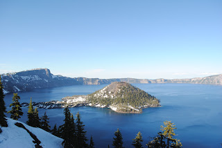 From one of these pulloffs, I (by now you know who's doing this) put together this panoramic. Of the three panoramic photos I've showed you, this is my least favorite. I believe many of those you will find are taken from Devil's Backbone. We didn't feel like climbing it.
We didn't spend much time here. In general, it is pretty spectacular, even with the snow, cold and mosquitoes. The lake is huge! And from up on the hillside, it looked as though it was frozen, but it was an illusion from being so far away. I would love to return when the daytime temperatures are around 70 or so and the snow is less.
I haven't read a lot about Crater Lake. But from what I experienced I can tell you it's definitely worth a visit. A caldera in the middle of this mountain range - pretty cool! But I question it's status as a national park. Although I've never studied the guidelines, the trends seem to be that a national park has a significant number of geological oddities, or offers a very unique and diverse landscape. Although this caldera is a spectacular oddity, that's about all the park is. It feels to me as though it should be a national monument.
We only stayed in the park for an hour or so and then continued to move. We eventually found a campsite outside the park where the mosquitoes were still bad, but tolerable.
Here's the short album (notice the sandals in the snow).
Redwood National Park
The next day we headed to Redwood National Park. As a coastal park with a lot of really big trees, it, like Olympic, has a funny layout. Here's the map (3.5 MB). It's an interesting story how the park got its shape and, like Olympic, it has to do with logging. Briefly, the area was being devastated by commercial logging because of the high quality of the wood (and, no doubt, the amount of wood per swing of the axe). Eventually, California caught on and created several "redwood" state parks. Later, NPS (National Park Service) came along and designated a Redwood National Park, which included three state parks in addition to other land. Today the state parks still hold their names although I'm not sure how the jurisdiction is arranged (which is why you see Redwood National and State Parks on this sign). The park services are working to restore these areas hurt by logging, but it will be 100+ years until the trees in that area reach a redwood height. Finally, to top of the similarities between Olympic and Redwood, it is US-101 that is the main road through/around both parks.
 Our first stop on US-101 was Enderts Beach (refer to map for location). It was a fun place to get the legs moving and take a break from the car for awhile. From there we headed to Klamath River Overlook, where we would begin our day hike (I had read in my handy-dandy book that this was the hike to do in Redwood).
Aside: My "summer bible" is National Geographic Guide to the National Parks of the United States (6th Edition). If you are a traveler of the national parks, this is a must-have. For my adventure, it's perfect. It gives background on each park, recommends activities based on the amount of time you plan to spend in each park and gives information on lodging and other activities (information that is sometimes difficult to find on NPS' website, representative of the state of our economy).
 The Coastal Trail runs throughout much of the park's coast, but I was recommended to do this particular portion. From Klamath River Overlook, it is about three miles to a hidden beach, named Hidden Beach. The beach is not accessible by car and, as my book told me, there are days when your footprints may be the only on the beach. For us, this was not one of those days, although we were the only people on the beach at the time.
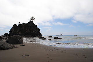 The trail was almost entirely through muggy forests (which looked somewhat similar to Olympic's forests) close to the ocean. About halfway to the beach, we heard a honking noise. The three of us stopped, looked at each other, and then sprinted down the trail to find an opening through the trees. We knew what it was. It was wild seal lions on the rocks near the shore! Unfortunately, there was no opening in the trees, and by the time we got to the beach we couldn't see the section of the beach where they were.
In other wildlife news, the banana slugs here are actually yellow (at Olympic they were brown). And we saw hoards of starfish at the beach as well as sea urchins.
We took a break at the beach and then headed back to the trailhead. From there we went to see the biggest tree in the park, named Big Tree. To put this tree in perspective, a 13-story building would fit underneath its first branch. Later, we went on a one-mile loop around some interesting redwoods. That night, we camped near a lagoon, although we could not see anything but trees from the campsite.
Redwood NP album
Next Post: Lassen Volcanic NP, Sierra Nevada Brewery and a Steak Dinner
Oregon
On the drive from Olympic to Crater Lake we reached a solid 73 degrees! It was the first time we had seen 70 since South Dakota, and it felt great!
We stopped in Eugene to get some gas and to pick up US-58. The following conversation took place:
Redwing41 (R): [Gets out of car]
Gas Station Attendant (G): I'll be right with you.
R: [Shrugs, puzzled; puts credit card in machine and grabs pump]
G: [Walks over to pump]. Hey! It's illegal to pump gas here, that's why I said I'd be right with you!
R: Okay. [Hands pump to G]
G: You're putting me out of a job! All these other states let people pump their own gas and then there's nothing for guys like me to do.
R: Yeah.
G: [Finishes pumping; replaces pump] Do you want a- [acts startled by receipt printing]. See, I would have known if you wanted a receipt because I would have asked you if you wouldn't have started pumping yourself. [Hands receipt to R]
R: Thanks. [Gets in car; leaves]
If you haven't been to Oregon, you may think this is nice; like the old days. It's not. They are the same exact pumps. When you pump gas you 1) put your card in, 2) choose your grade, 3) pump the gas, 4) replace the nozzle and 5) choose whether you would like a receipt. In Oregon, the process is:
- Attendant asks you how you would like to pay
- You hand attendant the card
- Attendant asks you if it's debit or credit
- You say "It doesn't say debit on the outside, so that's not even an option - but I'm glad I'm keeping you employed."
- Attendant takes offense, swipes your card anyways
- Attendant hands your card back
- Attendant asks you want grade you would like
- You say "It's a Nissan, so regular."
- Attendant gets more frustrated, pumps your gas anyways
- Attendant returns nozzle
- Attendant asks you if you want a receipt
- You say "No"
- Attendant thanks you, having earned $4.25 of their $8.50/hr wage for that hour.
So the thermometer stayed in the mid-70s all day, that is, until we were within 20 miles of the park. It's felt like we were the magnet to bad weather. In those 20 miles, we went from 70 to 45. And not only was it 45 at the park entrance, but the park was swarming with mosquitoes! To be cold and dealing with mosquitoes is not pleasant (foreshadowing, you'll see the opposite in an upcoming post).
Crater Lake National Park
Like Glacier and Rainier, much of Crater Lake's roads were closed. This was unfortunate because the rim drive is supposed to be spectacular. Fortunately, the portion that was open was near Devil's Backbone, which provides the nicest views of the lake and Wizard Island.
From one of these pulloffs, I (by now you know who's doing this) put together this panoramic. Of the three panoramic photos I've showed you, this is my least favorite. I believe many of those you will find are taken from Devil's Backbone. We didn't feel like climbing it.We didn't spend much time here. In general, it is pretty spectacular, even with the snow, cold and mosquitoes. The lake is huge! And from up on the hillside, it looked as though it was frozen, but it was an illusion from being so far away. I would love to return when the daytime temperatures are around 70 or so and the snow is less.
I haven't read a lot about Crater Lake. But from what I experienced I can tell you it's definitely worth a visit. A caldera in the middle of this mountain range - pretty cool! But I question it's status as a national park. Although I've never studied the guidelines, the trends seem to be that a national park has a significant number of geological oddities, or offers a very unique and diverse landscape. Although this caldera is a spectacular oddity, that's about all the park is. It feels to me as though it should be a national monument.
We only stayed in the park for an hour or so and then continued to move. We eventually found a campsite outside the park where the mosquitoes were still bad, but tolerable.
Here's the short album (notice the sandals in the snow).
Redwood National Park
The next day we headed to Redwood National Park. As a coastal park with a lot of really big trees, it, like Olympic, has a funny layout. Here's the map (3.5 MB). It's an interesting story how the park got its shape and, like Olympic, it has to do with logging. Briefly, the area was being devastated by commercial logging because of the high quality of the wood (and, no doubt, the amount of wood per swing of the axe). Eventually, California caught on and created several "redwood" state parks. Later, NPS (National Park Service) came along and designated a Redwood National Park, which included three state parks in addition to other land. Today the state parks still hold their names although I'm not sure how the jurisdiction is arranged (which is why you see Redwood National and State Parks on this sign). The park services are working to restore these areas hurt by logging, but it will be 100+ years until the trees in that area reach a redwood height. Finally, to top of the similarities between Olympic and Redwood, it is US-101 that is the main road through/around both parks.
Our first stop on US-101 was Enderts Beach (refer to map for location). It was a fun place to get the legs moving and take a break from the car for awhile. From there we headed to Klamath River Overlook, where we would begin our day hike (I had read in my handy-dandy book that this was the hike to do in Redwood).Aside: My "summer bible" is National Geographic Guide to the National Parks of the United States (6th Edition). If you are a traveler of the national parks, this is a must-have. For my adventure, it's perfect. It gives background on each park, recommends activities based on the amount of time you plan to spend in each park and gives information on lodging and other activities (information that is sometimes difficult to find on NPS' website, representative of the state of our economy).
The Coastal Trail runs throughout much of the park's coast, but I was recommended to do this particular portion. From Klamath River Overlook, it is about three miles to a hidden beach, named Hidden Beach. The beach is not accessible by car and, as my book told me, there are days when your footprints may be the only on the beach. For us, this was not one of those days, although we were the only people on the beach at the time.
The trail was almost entirely through muggy forests (which looked somewhat similar to Olympic's forests) close to the ocean. About halfway to the beach, we heard a honking noise. The three of us stopped, looked at each other, and then sprinted down the trail to find an opening through the trees. We knew what it was. It was wild seal lions on the rocks near the shore! Unfortunately, there was no opening in the trees, and by the time we got to the beach we couldn't see the section of the beach where they were.In other wildlife news, the banana slugs here are actually yellow (at Olympic they were brown). And we saw hoards of starfish at the beach as well as sea urchins.
We took a break at the beach and then headed back to the trailhead. From there we went to see the biggest tree in the park, named Big Tree. To put this tree in perspective, a 13-story building would fit underneath its first branch. Later, we went on a one-mile loop around some interesting redwoods. That night, we camped near a lagoon, although we could not see anything but trees from the campsite.
Redwood NP album
Next Post: Lassen Volcanic NP, Sierra Nevada Brewery and a Steak Dinner
Olympic National Park
Did you know there are rainforests in the lower 48? Well, there are. These forests I type of are temperate rain forests on the Olympic Peninsula in Washington State, most of which is considered Olympic National Park.
Unfortunately, because of the high quality of the wood, much of the peninsula has suffered from extreme logging. And it shows. As beautiful as the park is, it was a rather depressing trip to get there (through devastated forests). It's actually a funny setup. The parks forests and rain forests are preserved in the middle of the peninsula and, after a stretch of private land, the park resumes with several miles of preserves coast. Here's a park map (it's a 3MB download). The other interesting note is no road traverses the park. US-101 winds around the park, and various spurs travel 10+ miles into the park to a dead end. This preserves the beauty of the park but makes it difficult to see a lot in a short period of time.
Day 1
We entered from the east side. The first spur we entered was Hurricane Ridge (see map). It was a nice overlook that introduced the diversity of the park. Here's a cool panoramic I (again, Photoshop) put together from the overlook.
 Based on time, we decided to to head toward Sol Duc to camp for the night. On our way, we were able to check out Lake Crescent which provided some good photo opportunities. We also did a small hike to Marymere Falls.
On our way to the campground, we picked up some Washington beers and set up camp in the rainforest.
Day 2
 We wanted to hike through the rainforest, and had the perfect opportunity with the trail at Sol Duc. One mile in we came to Sol Duc Falls (that's where you lose the tourists). We continued to hike through the rainforest for about another mile or two, until we came to snow. Then we turned around and headed back to the car.
The rain forest was beautiful. It was full of green life - trees would grow from dead trees. Decomposition and regrowth seemed to be on an exponential scale to our Midwestern eyes. Surprisingly enough, we didn't see any wildlife (other than birds and insects). And guess what? It rained.
Hoh Rainforest is supposed to be the best in Olympic, but after spending the night and a three-hour hike in another rainforest, we'd had enough. We wanted the beach.
 So we continued on US-101 until we came to Ruby Beach. It's gorgeous. Aside: My girlfriend and I have taken two trips to Hunting Island State Park in South Carolina. During our two visits, we spent much time talking about how great it is to stand on a beach, turn away from the ocean, and not see giant condominiums, pools and transplanted palm trees. Ruby Beach had much of the same feel, except the trees were bigger, the outcroppings were interesting and beautiful and we were on the west coast.
We got our feet wet and explored for an hour or two and then began to look for a campsite. Kalaloch Campground is the only campground available for preregistration at Olympic, and it's on the beach. My hopes weren't high considering it was a Friday night. It turned out the campground was not really on the beach - you could walk to the beach - many of the sites were divided by trees, making it difficult to view the water. And I turned out to be correct - this giant campground was packed to the brim. We disappointingly moved on.
 And then, all of a sudden (ten minutes later), we came across a campground called South Beach - we hadn't seen it on the map. But there it was - a primitive campsite with no potable water. But it was as on the beach as a campground can be. Check it out! After our delicious feast, I noticed the sky was going to give me a beautiful sunset; and I was right.
One of my favorite photos came from this sunset. I was down shooting sunset photos for about an hour or so when my companions came down to keep me company. At one point, one of them was in front of the camera while I was wanting to take another photo. While I was yelling (asking politely) for him to move, my other companion jumped in front of the camera while I shot the photo not wanting to miss the sky at that moment. And this moody photo came about. It's what The Beatles would have called a happy accident.
Day 3
The next day we awoke and jumped on the road in an effort to get to Crater Lake before dark (we were already at the southwestern edge of the park and therefore weren't missing out on anything else).
The entire Olympic NP photo album.
Next Post: Crater Lake & Redwood National Parks
Unfortunately, because of the high quality of the wood, much of the peninsula has suffered from extreme logging. And it shows. As beautiful as the park is, it was a rather depressing trip to get there (through devastated forests). It's actually a funny setup. The parks forests and rain forests are preserved in the middle of the peninsula and, after a stretch of private land, the park resumes with several miles of preserves coast. Here's a park map (it's a 3MB download). The other interesting note is no road traverses the park. US-101 winds around the park, and various spurs travel 10+ miles into the park to a dead end. This preserves the beauty of the park but makes it difficult to see a lot in a short period of time.
Day 1
We entered from the east side. The first spur we entered was Hurricane Ridge (see map). It was a nice overlook that introduced the diversity of the park. Here's a cool panoramic I (again, Photoshop) put together from the overlook.
Based on time, we decided to to head toward Sol Duc to camp for the night. On our way, we were able to check out Lake Crescent which provided some good photo opportunities. We also did a small hike to Marymere Falls.On our way to the campground, we picked up some Washington beers and set up camp in the rainforest.
Day 2
We wanted to hike through the rainforest, and had the perfect opportunity with the trail at Sol Duc. One mile in we came to Sol Duc Falls (that's where you lose the tourists). We continued to hike through the rainforest for about another mile or two, until we came to snow. Then we turned around and headed back to the car.The rain forest was beautiful. It was full of green life - trees would grow from dead trees. Decomposition and regrowth seemed to be on an exponential scale to our Midwestern eyes. Surprisingly enough, we didn't see any wildlife (other than birds and insects). And guess what? It rained.
Hoh Rainforest is supposed to be the best in Olympic, but after spending the night and a three-hour hike in another rainforest, we'd had enough. We wanted the beach.
So we continued on US-101 until we came to Ruby Beach. It's gorgeous. Aside: My girlfriend and I have taken two trips to Hunting Island State Park in South Carolina. During our two visits, we spent much time talking about how great it is to stand on a beach, turn away from the ocean, and not see giant condominiums, pools and transplanted palm trees. Ruby Beach had much of the same feel, except the trees were bigger, the outcroppings were interesting and beautiful and we were on the west coast.We got our feet wet and explored for an hour or two and then began to look for a campsite. Kalaloch Campground is the only campground available for preregistration at Olympic, and it's on the beach. My hopes weren't high considering it was a Friday night. It turned out the campground was not really on the beach - you could walk to the beach - many of the sites were divided by trees, making it difficult to view the water. And I turned out to be correct - this giant campground was packed to the brim. We disappointingly moved on.
And then, all of a sudden (ten minutes later), we came across a campground called South Beach - we hadn't seen it on the map. But there it was - a primitive campsite with no potable water. But it was as on the beach as a campground can be. Check it out! After our delicious feast, I noticed the sky was going to give me a beautiful sunset; and I was right.One of my favorite photos came from this sunset. I was down shooting sunset photos for about an hour or so when my companions came down to keep me company. At one point, one of them was in front of the camera while I was wanting to take another photo. While I was yelling (asking politely) for him to move, my other companion jumped in front of the camera while I shot the photo not wanting to miss the sky at that moment. And this moody photo came about. It's what The Beatles would have called a happy accident.
Day 3
The next day we awoke and jumped on the road in an effort to get to Crater Lake before dark (we were already at the southwestern edge of the park and therefore weren't missing out on anything else).
The entire Olympic NP photo album.
Next Post: Crater Lake & Redwood National Parks
7.15.2011
Viewing My Photos
It was brought to my attention it's not so easy to navigate through Picasa's albums. There are several ways to look through an album - I've explained them below.
The Slideshow
 When you click one of my web album links, you are redirected to that album's homepage. If you look to the bottom and left of the album title, you'll see a button titled Slideshow (see screenshot to the right). This will take you to a slideshow of the album in which you can navigate using the arrows at the bottom of the page or the arrows on your keyboard.
From A Photo
All other ways begin with you clicking on a photo to enlarge it. If you want to view all photos, click on the first photo in the album. In the location of the slideshow button I talked about above is a new button titled Full Screen. Consider this to be the same button - it takes you to the slideshow, beginning with the photo you had pulled up.
But you don't have to go to the slideshow to easily navigate through the albums. When looking at an enlarged photo, you should be able to use your arrow keys on your keyboard to navigate quickly through photos. Otherwise, if you float your mouse to the left or right side of a photo, an arrow appears. Clicking on the left or right arrow will move you to the previous or next photo, respectively.
I hope this clears any issues. Leave comments or contact me if you have additional questions.
The Slideshow
When you click one of my web album links, you are redirected to that album's homepage. If you look to the bottom and left of the album title, you'll see a button titled Slideshow (see screenshot to the right). This will take you to a slideshow of the album in which you can navigate using the arrows at the bottom of the page or the arrows on your keyboard.From A Photo
All other ways begin with you clicking on a photo to enlarge it. If you want to view all photos, click on the first photo in the album. In the location of the slideshow button I talked about above is a new button titled Full Screen. Consider this to be the same button - it takes you to the slideshow, beginning with the photo you had pulled up.
But you don't have to go to the slideshow to easily navigate through the albums. When looking at an enlarged photo, you should be able to use your arrow keys on your keyboard to navigate quickly through photos. Otherwise, if you float your mouse to the left or right side of a photo, an arrow appears. Clicking on the left or right arrow will move you to the previous or next photo, respectively.
I hope this clears any issues. Leave comments or contact me if you have additional questions.
7.14.2011
North Cascades & Mount Rainier National Parks
From the west entrance of Glacier NP, you're basically in the northwest corner of Montana. The thing about Montana is it's big - it still took 3+ hours to get out of the state.
The exit of Montana marked my first new state on this trip - Idaho. Although we were only in northern Idaho and only for about an hour, I can say it was beautiful country. Also, we learned from a bathroom stall that Northern Idahoans are generally illiterate - bathroom stalls don't lie.
Next was Washington. What comes to mind first when thinking about Washington state? Probably Seattle, or maybe it's the Tacoma Narrows Bridge. The difference between Washington and the previous few states is there are people there! Washington is the 18th largest in terms of area and 13th in terms of population (60% of which live in the Seattle area). Washington also has three national parks.
North Cascades National Park
The first of these three is North Cascades. Commonly called The Alps of North America, this park sits in northern central Washington. On our drive to the park, we saw real cowboys!
 North Cascades was beautiful, but it was a weird setup. The road that "traverses" the park actually never enters the park (notice in the photo album the park sign is not the real sign). In fact, it crosses through Ross Lake National Recreation Area in between the northern and southern portions of the park. After reading more about it, it is difficult to visit the park without planning for an extended stay. But what we could see looked beautiful!
Here are a few photos I was able to gather.
Mount Rainier National Park
After a night outside the park we made our way to I-5 so my two companions could see the Seattle skyline for the first time, although we did not make a stop here. This was my third time in the Seattle area and the third time it was chilly and overcast. Entering Mount Rainier NP marked the second time I did so and the second time it was cloudy and the second time some of the roads were closed.
 I wondered, as I sat frustrated in the car, how people capture these wonderful photos I see in the picture books of Mount Rainier. I'm convinced they sit in one spot for three years waiting for a sunny day. The sky did open up at a few places and enabled us to capture a few good photos. Even with these photos, it's frustrating to come so far and strikeout twice in one day. We were anxious to get to the next park, which meant getting to the ocean.
Here's another abbreviated Washington album.
Next Post: Olympic National Park
The exit of Montana marked my first new state on this trip - Idaho. Although we were only in northern Idaho and only for about an hour, I can say it was beautiful country. Also, we learned from a bathroom stall that Northern Idahoans are generally illiterate - bathroom stalls don't lie.
Next was Washington. What comes to mind first when thinking about Washington state? Probably Seattle, or maybe it's the Tacoma Narrows Bridge. The difference between Washington and the previous few states is there are people there! Washington is the 18th largest in terms of area and 13th in terms of population (60% of which live in the Seattle area). Washington also has three national parks.
North Cascades National Park
The first of these three is North Cascades. Commonly called The Alps of North America, this park sits in northern central Washington. On our drive to the park, we saw real cowboys!
North Cascades was beautiful, but it was a weird setup. The road that "traverses" the park actually never enters the park (notice in the photo album the park sign is not the real sign). In fact, it crosses through Ross Lake National Recreation Area in between the northern and southern portions of the park. After reading more about it, it is difficult to visit the park without planning for an extended stay. But what we could see looked beautiful!Here are a few photos I was able to gather.
Mount Rainier National Park
After a night outside the park we made our way to I-5 so my two companions could see the Seattle skyline for the first time, although we did not make a stop here. This was my third time in the Seattle area and the third time it was chilly and overcast. Entering Mount Rainier NP marked the second time I did so and the second time it was cloudy and the second time some of the roads were closed.
I wondered, as I sat frustrated in the car, how people capture these wonderful photos I see in the picture books of Mount Rainier. I'm convinced they sit in one spot for three years waiting for a sunny day. The sky did open up at a few places and enabled us to capture a few good photos. Even with these photos, it's frustrating to come so far and strikeout twice in one day. We were anxious to get to the next park, which meant getting to the ocean.Here's another abbreviated Washington album.
Next Post: Olympic National Park
Glacier National Park
While Yellowstone NP sits in the northwest corner of Wyoming, a small portion is within the boundaries of Montana (and a little in Idaho). In my two previous visits, I had either entered or exited the park through one of the three Montana entrances. Montana, therefore, was not a new state for me, although my time spent there could be counted in hours.
Aside from these two roads and the small portion of the park, I knew nothing about Montana. So why not share some facts? Montana:
Glacier National Park (Day 1)
 Like Yellowstone, we entered the park in the evening and found a campsite close to the border. Although we could see the mountains before entering the park, it isn't until we were within the park's border the beauty really appears. And it smacks you in the face. Aside: Glacier National Park continues into Canada as Waterton Lakes National Park. I mention this only because I find Canada's name choice to be more fitting. The mountains are incredible (as are the glaciers), but the beauty within this park is brought about by the foreground of massive, natural lakes. The view from our first night's campsite wasn't too shabby either.
Day 2
Again, like Yellowstone, we wanted to another short backpacking trip. After obtaining our backcountry permit, we were off to our 8.7 mile hike in to the campsite named Lake Cosley. On our way to the trailhead, we spotted a bear running through a field in the distance. We debated what type of bear this was, but after studying the differences in the Glacier Visitors' Center, I'm leaning towards it being a grizzly bear (one such characteristic difference, unfortunately, is not color - black bears can be black, brown or blonde).
 I'll keep the story about our hike to our backcountry campsite short. It was a beautiful 60-degree day. Most of the hike was spent walking through meadows and forests between mountains. The views were just spectacular, and they never stopped. Here's a panoramic I (meaning Photoshop) pieced together from one of the meadows. The coolest story from that day was we had to cross a rope bridge to continue on the trail (where rope here was actually steel cables). Finally, the view from our backcountry campsite makes it the coolest campsite at which I've ever stayed. After eating dinner, we were sitting on a log on the lakeshore, and one of my companions spotted a black bear walking on the other side of the lake. We were able to watch the bear for about 20 minutes as it walked along the shore looking for food. Fortunately, it never made its way to our campsite.
Day 3
The third day was spent walking this trail back out to the car, then driving around the park (since we couldn't traverse the Going To The Sun Road) to camp on the west side. The only significant and different event of the day included eating a buffalo burger at the St. Mary Lodge (our first time eating out since leaving). Even with the main road was closed, it was a good decision to camp on the west side, just to see the difference in vegetation. As you could see in our photos, our hike (which was on the east side of the mountains) consisted of mostly meadows and little, short vegetation. But on the west side (where it rains much more), the grass is greener and the trees are larger. That drive around the park made it feel as though we were entering a different park.
Day 4
 We woke up the next morning and headed toward Washington and North Cascades National Park, but we first had to stop for gifts. I am so grateful of our timing here, because without stopping and camping where we did, I wouldn't have taken my favorite photo from leg 1.
The entire Glacier National Park album
Next Post: North Cascades National Park and Mount Rainier National Park
Aside from these two roads and the small portion of the park, I knew nothing about Montana. So why not share some facts? Montana:
- Comes from the Spanish word meaning mountain (automatically making it awesome)
- Is the third largest state in terms of area but the seventh lowest in terms of people (making it the third lowest in population density - can you name the top two?)
- Contains seven American Indian reservations and two national parks
Glacier National Park (Day 1)
Like Yellowstone, we entered the park in the evening and found a campsite close to the border. Although we could see the mountains before entering the park, it isn't until we were within the park's border the beauty really appears. And it smacks you in the face. Aside: Glacier National Park continues into Canada as Waterton Lakes National Park. I mention this only because I find Canada's name choice to be more fitting. The mountains are incredible (as are the glaciers), but the beauty within this park is brought about by the foreground of massive, natural lakes. The view from our first night's campsite wasn't too shabby either.Day 2
Again, like Yellowstone, we wanted to another short backpacking trip. After obtaining our backcountry permit, we were off to our 8.7 mile hike in to the campsite named Lake Cosley. On our way to the trailhead, we spotted a bear running through a field in the distance. We debated what type of bear this was, but after studying the differences in the Glacier Visitors' Center, I'm leaning towards it being a grizzly bear (one such characteristic difference, unfortunately, is not color - black bears can be black, brown or blonde).
I'll keep the story about our hike to our backcountry campsite short. It was a beautiful 60-degree day. Most of the hike was spent walking through meadows and forests between mountains. The views were just spectacular, and they never stopped. Here's a panoramic I (meaning Photoshop) pieced together from one of the meadows. The coolest story from that day was we had to cross a rope bridge to continue on the trail (where rope here was actually steel cables). Finally, the view from our backcountry campsite makes it the coolest campsite at which I've ever stayed. After eating dinner, we were sitting on a log on the lakeshore, and one of my companions spotted a black bear walking on the other side of the lake. We were able to watch the bear for about 20 minutes as it walked along the shore looking for food. Fortunately, it never made its way to our campsite.Day 3
The third day was spent walking this trail back out to the car, then driving around the park (since we couldn't traverse the Going To The Sun Road) to camp on the west side. The only significant and different event of the day included eating a buffalo burger at the St. Mary Lodge (our first time eating out since leaving). Even with the main road was closed, it was a good decision to camp on the west side, just to see the difference in vegetation. As you could see in our photos, our hike (which was on the east side of the mountains) consisted of mostly meadows and little, short vegetation. But on the west side (where it rains much more), the grass is greener and the trees are larger. That drive around the park made it feel as though we were entering a different park.
Day 4
We woke up the next morning and headed toward Washington and North Cascades National Park, but we first had to stop for gifts. I am so grateful of our timing here, because without stopping and camping where we did, I wouldn't have taken my favorite photo from leg 1.The entire Glacier National Park album
Next Post: North Cascades National Park and Mount Rainier National Park
7.12.2011
Yellowstone National Park
Wyoming. What do you know about it? I feel as though it is a state that is often overlooked by us Easterners; so I'll share a few facts. Wyoming:
 Only on day two of the trip and growing tired of the tight quarters, we entered this beautiful state on I-90. Although this was my third time on this stretch of road, it was no less fascinating. After exiting the interstate, we took US-14 through the Bighorn mountain range. The Bighorns are a random extension of the Rockies, just hanging out in the middle of the desert. It's quite a fun drive. The photo to the left was from a pull-off at one of the passes in the range.
Although Wyoming is beautiful, there is little to entertain yourself with other than the national parks in the northwest corner of the state (unless you are into rodeos). Devil's Tower is located in the northeast part of the state and was somewhat on our way. Unfortunately, we didn't stop due to time constraints.
On the way to Yellowstone from the east, you first enter Shoshone National Forest, where the foothills really begin to take shape. It was during dusk we drove through this area, and saw two moose, an elk and a buffalo before entering the national park (if you click on the links, it will take you to our photos).
Yellowstone National Park (Day 1)
We entered the park around 9:00 p.m. only to be told the entire park was booked for camping. I was amazed considering the temperature in the 40s at this point, but our decision to call ahead saved us, and we proceeded to the Bay Bridge campground. When checking in, the nice lady who said, "No Twinkies under the pillow - there are bears here," also informed us someone had seen a mother grizzly and two cubs near the campground! Perhaps it was the now famous bear - we were okay with not seeing her.
Day 2
We set out early the next morning to acquire a permit to do some backcountry hiking and camping. On the way to do so, we saw a black bear in a clearing, but did not capture any photos of it given our anxiety to get on the trail. Ranger Dillon helped us with the permit and we were off!
The campsite was only about a mile in from the road. We had wanted it to be farther in but were steered away from it because of the water level of a usually-passable river. Before even reaching our campsite we saw a fresh bear track in the mud (link is to photo). Again, fortunately, we never encountered a bear at a close distance.
 We hiked to the impassable river and explored for a few hours. One of my companions refused to deem the river as impassable and crossed it on a slippery log just for fun. After awhile we returned to the campsite and cooked dinner. The campsite, coincidentally named Ice Lake, was cold and windy. When writing in our journals that evening, it began to snow! We were ill-prepared on this summer vacation to encounter snow (at least not at 7,000 feet). It got as low as 28 degrees that night.
Sitting in the tent, warm in the sleeping bags, we decided not to walk this trail the following day. It just didn't make sense to come to Yellowstone and hike on a forest trail mostly made up of burnt trees (from the 1988 fires). We wanted to see some real Yellowstone features.
Day 3
What we decided upon was to walk around the Yellowstone Canyon. When approaching the trailhead with our daypacks a lady walked our way and said, "You guys look pretty typical, can I take a picture of you?" We looked at her confused as she snapped a photo and then ran away.
 The hike was phenomenal. We hiked around 8 miles or so. The waterfall lookouts were teeming with tourists in their jeans, tennis shoes, tucked-in t-shirts and fanny packs, hiking their half-mile or so to get to a good photo opportunity. With our 3-liter water bladders, backpacks, synthetic pants and goofy hats, we pretended we were doing more work to get to those lookouts. But in truth, the best part of the trail was when we got into the backcountry and were able to explore Yellowstone's natural sulfur springs with no company.
The third night went much the same as the second, although we were much more tired and satisfied from the hike. Plus, it only got down to 33 degrees that night.
Day 4
 The next morning we drove to Mammoth Hot Springs on our way out of the park from the northwest entrance. Although we tried, we never made it to the Upper Geyser Basin, where Old Faithful and Morning Glory Pool are located. We got caught in a traffic jam and didn't want to be stuck past dark. However, because we never made it to the Grand Tetons, I (according to my rules) have to make it back this way before the end of the summer. Thus, I should be able to reach that corner of the park and get some good photos.
Entire Yellowstone Photo Album
Next post: Montana and Glacier National Park
- Is the tenth largest state in terms of area, but it is the least populous.
- Was the first state to grant suffrage to women.
- Levies no corporate or individual income tax.
- Has two national parks - Yellowstone and Grand Tetons.
- Has an elevation difference of more than 10,000 feet.
- Is awesome.
Only on day two of the trip and growing tired of the tight quarters, we entered this beautiful state on I-90. Although this was my third time on this stretch of road, it was no less fascinating. After exiting the interstate, we took US-14 through the Bighorn mountain range. The Bighorns are a random extension of the Rockies, just hanging out in the middle of the desert. It's quite a fun drive. The photo to the left was from a pull-off at one of the passes in the range.Although Wyoming is beautiful, there is little to entertain yourself with other than the national parks in the northwest corner of the state (unless you are into rodeos). Devil's Tower is located in the northeast part of the state and was somewhat on our way. Unfortunately, we didn't stop due to time constraints.
On the way to Yellowstone from the east, you first enter Shoshone National Forest, where the foothills really begin to take shape. It was during dusk we drove through this area, and saw two moose, an elk and a buffalo before entering the national park (if you click on the links, it will take you to our photos).
Yellowstone National Park (Day 1)
We entered the park around 9:00 p.m. only to be told the entire park was booked for camping. I was amazed considering the temperature in the 40s at this point, but our decision to call ahead saved us, and we proceeded to the Bay Bridge campground. When checking in, the nice lady who said, "No Twinkies under the pillow - there are bears here," also informed us someone had seen a mother grizzly and two cubs near the campground! Perhaps it was the now famous bear - we were okay with not seeing her.
Day 2
We set out early the next morning to acquire a permit to do some backcountry hiking and camping. On the way to do so, we saw a black bear in a clearing, but did not capture any photos of it given our anxiety to get on the trail. Ranger Dillon helped us with the permit and we were off!
The campsite was only about a mile in from the road. We had wanted it to be farther in but were steered away from it because of the water level of a usually-passable river. Before even reaching our campsite we saw a fresh bear track in the mud (link is to photo). Again, fortunately, we never encountered a bear at a close distance.
We hiked to the impassable river and explored for a few hours. One of my companions refused to deem the river as impassable and crossed it on a slippery log just for fun. After awhile we returned to the campsite and cooked dinner. The campsite, coincidentally named Ice Lake, was cold and windy. When writing in our journals that evening, it began to snow! We were ill-prepared on this summer vacation to encounter snow (at least not at 7,000 feet). It got as low as 28 degrees that night.Sitting in the tent, warm in the sleeping bags, we decided not to walk this trail the following day. It just didn't make sense to come to Yellowstone and hike on a forest trail mostly made up of burnt trees (from the 1988 fires). We wanted to see some real Yellowstone features.
Day 3
What we decided upon was to walk around the Yellowstone Canyon. When approaching the trailhead with our daypacks a lady walked our way and said, "You guys look pretty typical, can I take a picture of you?" We looked at her confused as she snapped a photo and then ran away.
The hike was phenomenal. We hiked around 8 miles or so. The waterfall lookouts were teeming with tourists in their jeans, tennis shoes, tucked-in t-shirts and fanny packs, hiking their half-mile or so to get to a good photo opportunity. With our 3-liter water bladders, backpacks, synthetic pants and goofy hats, we pretended we were doing more work to get to those lookouts. But in truth, the best part of the trail was when we got into the backcountry and were able to explore Yellowstone's natural sulfur springs with no company.The third night went much the same as the second, although we were much more tired and satisfied from the hike. Plus, it only got down to 33 degrees that night.
Day 4
The next morning we drove to Mammoth Hot Springs on our way out of the park from the northwest entrance. Although we tried, we never made it to the Upper Geyser Basin, where Old Faithful and Morning Glory Pool are located. We got caught in a traffic jam and didn't want to be stuck past dark. However, because we never made it to the Grand Tetons, I (according to my rules) have to make it back this way before the end of the summer. Thus, I should be able to reach that corner of the park and get some good photos.Entire Yellowstone Photo Album
Next post: Montana and Glacier National Park
Subscribe to:
Comments (Atom)