Before I get into post-trip posts, I wanted to issue a handful of well-deserved thank yous.
First, thank you to all of you who have followed (and may continue to follow) at any point throughout the summer. I hope I have provided you with a little entertainment from time-to-time and perhaps even a chance to live vicariously through my stories and photos. While I have kept a handwritten journal throughout the trip, I've certainly written about stories which I forgot to include in my journal. Thus, by maintaining this blog, I've essentially created a second journal for myself.
Second, and more importantly, thank you to those of you have contributed to me being able to take this incredible trip. No one deserves more thanks than my parents. Without helping me fund my college career, I would have never had the money to do this. In most life scenarios, my parents play the role of bringing my fantastical ideas down to reality; but in this trip, they maintained a positive attitude and made me think I could actually do this trip (if I went about planning it intelligently). And after two years of planning and saving, I think I did a pretty good job.
My girlfriend sat through two years of me planning what my trip would be. From wanting to go to Europe to seeing the United States, from wanting to travel together to wanting to do the whole thing alone to combining the two into a comfortable compromise. And for being near the phone when I felt lonely and for taking care of the things I could not by not being in Cincinnati, she rocks! Plus, she had to deal with the lack of my magical presence, which can't be easy for anyone.
My employer went against its culture and enabled me the time off and a spot when I came back.
Several people gave graduation presents. And while I had saved what I needed for the trip, these gifts provided a financial backdrop, i.e., I wasn't going to come back broke!
Several others provided me with encouragement. The most spoken phrase to me throughout my last two years of school was, "You definitely have to take this trip while you can." It was this encouragement that I believe really made me think I could do it. Then, after the trip was planned people would ask me, "Who are you going with?" I'd answer, "No one, for the majority of the trip." Most would return with, "Wow! I couldn't do that." This gave me even more incentive to go - to prove I could be on my own for that long.
Finally, for those who joined me. Specifically, my two buddies in Leg 1, my parents and girlfriend (at different times) in Leg 2 and the friends who put me up and put up with me for a night or two in Minneapolis, Cincinnati, Blacksburg, Jacksonville and Atlanta. All, and I mean all, of these people took away the potential for loneliness with their company and also lessened the financial burden in one way or another.
And for anyone else I missed who thinks you may have contributed to this trip, you probably did. Thank you.
No, it wasn't what I had planned, but truthfully, it couldn't have been better.
9.29.2011

Congaree National Park
Have you visited South Carolina before? If you have, you were probably headed to one of the many destination points long the coast, and you may not have realized you weren't all that far from a national park.
Congaree National Park is located just south of Columbia. I wonder how many people in Columbia don't know of its existence.
 It is beautiful, while it has a slightly odd setup. It is a small park. Consider the numbers I presented in the last post. The smallest of those parks, Rocky Mountain, has an area of roughly 260,000 acres. Decrease that tenfold to 26,000 acres and you have the size of Congaree.
With that stated, size is not proportional to beauty (insert Michael Scott joke here). Congaree preserves the largest area of old-growth, bottomland, hardwood forest in the United States. That may sound like a lot of specifications, like he's the only pitcher to strikeout three batters in one inning on his mother's 50th birthday, who has a black lab and three goldfish as pets. The truth is it's not that obscure. This forest used to stretch from Northern Virginia to East Texas, or roughly 24 million acres. Remember my rant about not being forward-thinking in the east? Case closed.
 Congaree also contains the highest temperate canopies (deciduous inferred) in the world (although some South American forests come close or exceed this forest in certain places).
Congaree is not only a free-entrance park with free camping and the legal collecting of firewood, but it contains virtually no roads within the park.
Day 65
After an early start in GSMNP, I made good time getting to Congaree. I visited the visitor center to obtain my free camping permit and headed out for a hike. Behind the visitor center is a 2.5-mile boardwalk trail through the forest. Walking through the forest, I really didn't feel as though I was in the eastern United States. Although extremely small, it really felt like it was some exotic land not named South Carolina.
Day 66
The next morning I got ready early for a big hike - sadly, my last of the trip.
I began with a section of the boardwalk trail. From this photo you can see the water line on the trees. Here's a tricky-but-cool statistic: 80% of the park floods, on average, 10 times every year. Yet, I don't believe it is technically a rain forest. But the humidity is no less apparent than in Olympic. One woman called the water lines tide lines; I wanted to pat her on the head and say, "Good try, but I don't think the ocean makes it all the way to Central South Carolina."
The park was not very crowded, which was very nice for being my last day in a park. However, because of this, for many of the trails I hiked, I was the first line of defense against last night's cobwebs. Being tangled up in cobwebs is not a great feeling, especially when the spiders look like this. What was amazing is I don't think I was bitten once.
I sat and had lunch on a bridge with this view.
 I was also excited to see some new wildlife. Other than a deer, I saw a wild pig, but he was running away so fast, I wasn't able to get a photo of him. Later, I thought I saw a good photo opportunity along a creek, so I stepped off trail to look. It didn't end up being a good a photo, but when I stepped back on the trail, I saw two snakes which appeared to be fighting? Like the bears, I took about a million photos, and a few of them turned out okay.
At one point, they both stopped and had their heads pointed my way. I figured I was a bit too close and went back to pack up the camera. When I turned, I knew one was in the grass next to the trail, but I really could not see it. I began wondering how many times I missed cool wildlife that was blended into the background. And maybe not just animals which blend into the background, but even ones I just missed. For example, at Grand Canyon NP, I followed a giant elk through the woods. He eventually came out onto the road and disappeared into the woods on the other side of the road. The cars which passed immediately following would have had no idea what they missed. Or, if you remember the grizzly bear I saw in Yellowstone, I was only about one minute from missing him entirely.
Congaree National Park Album
This concluded my national park tour.
On Day 67, I visited a high school friend in Jacksonville, Florida. It was great catching up and playing guitar with someone other than my invisible friend. The day following I spent briefly in Atlanta catching up with more friends.
Day 69 was my trip back to Cincinnati and the bittersweet ending to an unbeatable summer.
Like I've mentioned before, the remaining posts will consist of reflections and lists throughout the month of October.
Congaree National Park is located just south of Columbia. I wonder how many people in Columbia don't know of its existence.
It is beautiful, while it has a slightly odd setup. It is a small park. Consider the numbers I presented in the last post. The smallest of those parks, Rocky Mountain, has an area of roughly 260,000 acres. Decrease that tenfold to 26,000 acres and you have the size of Congaree.With that stated, size is not proportional to beauty (insert Michael Scott joke here). Congaree preserves the largest area of old-growth, bottomland, hardwood forest in the United States. That may sound like a lot of specifications, like he's the only pitcher to strikeout three batters in one inning on his mother's 50th birthday, who has a black lab and three goldfish as pets. The truth is it's not that obscure. This forest used to stretch from Northern Virginia to East Texas, or roughly 24 million acres. Remember my rant about not being forward-thinking in the east? Case closed.
Congaree also contains the highest temperate canopies (deciduous inferred) in the world (although some South American forests come close or exceed this forest in certain places).Congaree is not only a free-entrance park with free camping and the legal collecting of firewood, but it contains virtually no roads within the park.
Day 65
After an early start in GSMNP, I made good time getting to Congaree. I visited the visitor center to obtain my free camping permit and headed out for a hike. Behind the visitor center is a 2.5-mile boardwalk trail through the forest. Walking through the forest, I really didn't feel as though I was in the eastern United States. Although extremely small, it really felt like it was some exotic land not named South Carolina.
Day 66
The next morning I got ready early for a big hike - sadly, my last of the trip.
I began with a section of the boardwalk trail. From this photo you can see the water line on the trees. Here's a tricky-but-cool statistic: 80% of the park floods, on average, 10 times every year. Yet, I don't believe it is technically a rain forest. But the humidity is no less apparent than in Olympic. One woman called the water lines tide lines; I wanted to pat her on the head and say, "Good try, but I don't think the ocean makes it all the way to Central South Carolina."
The park was not very crowded, which was very nice for being my last day in a park. However, because of this, for many of the trails I hiked, I was the first line of defense against last night's cobwebs. Being tangled up in cobwebs is not a great feeling, especially when the spiders look like this. What was amazing is I don't think I was bitten once.
I sat and had lunch on a bridge with this view.
I was also excited to see some new wildlife. Other than a deer, I saw a wild pig, but he was running away so fast, I wasn't able to get a photo of him. Later, I thought I saw a good photo opportunity along a creek, so I stepped off trail to look. It didn't end up being a good a photo, but when I stepped back on the trail, I saw two snakes which appeared to be fighting? Like the bears, I took about a million photos, and a few of them turned out okay.At one point, they both stopped and had their heads pointed my way. I figured I was a bit too close and went back to pack up the camera. When I turned, I knew one was in the grass next to the trail, but I really could not see it. I began wondering how many times I missed cool wildlife that was blended into the background. And maybe not just animals which blend into the background, but even ones I just missed. For example, at Grand Canyon NP, I followed a giant elk through the woods. He eventually came out onto the road and disappeared into the woods on the other side of the road. The cars which passed immediately following would have had no idea what they missed. Or, if you remember the grizzly bear I saw in Yellowstone, I was only about one minute from missing him entirely.
Congaree National Park Album
This concluded my national park tour.
On Day 67, I visited a high school friend in Jacksonville, Florida. It was great catching up and playing guitar with someone other than my invisible friend. The day following I spent briefly in Atlanta catching up with more friends.
Day 69 was my trip back to Cincinnati and the bittersweet ending to an unbeatable summer.
Like I've mentioned before, the remaining posts will consist of reflections and lists throughout the month of October.
Blue Ridge Parkway & Great Smoky Mountains National Park
Day 63
My night in Blacksburg was a great time. What I didn't mention before was the friend I was visiting was one of my companions from Leg 1 of this trip. It was great to see him again, to catch up and to tell him how obviously better Leg 1 was because he was a part of it.
That night he had some friends over, and we drank beer and watched a football game. I'd forgot what football was. I still like it.
Blue Ridge Parkway
 After leaving Blacksburg, I drove towards Blue Ridge Parkway to finish the second, southern half of the parkway. The parkway is set up similar to the Nacthez Trace Parkway, if you recall that post. The difference was the scenery. What a cool road this is!
Unfortunately for you, I did not take very many photos. Also, it was cloudy, so the photos I did take did not turn out all that well. And believe me, to properly photograph this 467-mile road could take a month or more. Here is the only photo of the parkway I have posted. This road may very well make the list.
Great Smoky Mountains National Park
While a beautiful drive, it was also a very long drive (467 miles at 45 mph), and it was good to make it to camp at GSMNP. It was also very cold! When I arrived at camp it was less than 50 degrees. After thinking about this, I believe it was the coldest temperature I'd experienced since the first trip to Glacier NP (a long time ago).
 On the way to camp, I encountered some elk along the side of the road. Although I've seen many elk this summer, this was especially cool because the road was not busy, they were close to the road, and I captured one sitting down.
Day 64
I really only had one day to visit the park. I purposefully chose a camp in the southern section of the park so I could get out earlier the next day.
Unlike my first two east coast parks, I've been to GSMNP three times previously. Yet, somehow I forgot how incredibly large the park is (especially for being east of the Mississippi). As a result, I chose to focus more on driving than hiking.
 I started by driving the park's main road, which is actually an extension of Blue Ridge Parkway. From there, I connected to the road to Cades Cove, which has a slow, 12-mile, scenic driving loop. Most of my photos of the park were from this loop, including one of the better landscapes.
The speed limit on this road is 20 mph. It's meant for vehicles to move slowly, but not too slowly. Like many of the other parks, signs are posted which say to use turnouts to stop or to let other vehicles pass. I was in Tennessee, where the average teeth per person competes with IQ year after year.
Eventually I came to a place where I could not move. My first thought was, There's a bear up there! My second thought, immediately following, was, If it's a deer or an elk, I'm going to punch somebody.
It wasn't a bear.
It was three bears, in a tree. I took a million photos and tried to keep only the best. This one starts the set. This one, immediately following the set, is of all the people taking photos of the bears. I decided to act as tourist here because I really wanted some black bear photos. And I'd say I got some!
 There were two rangers here attempting to move traffic along and keep people far enough from the tree. It was a good strategy - they had everyone drive past the tree, park and get out of their vehicles to take photos. This way, all the tourists were only on one side of the tree, giving the bears proper room and, if they felt uncomfortable, a direction in which to leave the area.
At one point, two morons stepped out of their car directly under the tree in the road. At that point, Mama Bear walked clear over to the other side of the tree, directly above them. This is when the ranger began screaming at them. I wish she wouldn't have, I wanted to see someone (who deserved it) get eaten.
After completing the loop, I headed back to camp, stopping at a trail called Quiet Walkway on the way. There are several of these throughout the park and they are awesome! The park is overcrowded, but much of the population remains either on the road or on the most popular trails. Therefore, these walkways are secluded and a nice break from the people. I tried my hand at some more moving water.
About the Park and Its Bears
I've talked about overcrowded parks on many occasions this summer. I wanted to put it into perspective for you, so I've created a list of the top five most visited parks (from 2010), their area and the ensuing calculation of visitors per year per acre. Here you go:
1) Grand Canyon: 4.4 million visitors / 1.2 million acres = 3.67
2) Yosemite: 3.9 million visitors / 0.76 million acres = 5.13
3) Yellowstone: 3.6 million visitors / 2.2 million acres = 1.63
4) Rocky Mountain: 3.0 million visitors / 0.26 million acres = 11.54
5) Olympic: 2.8 million visitors / 0.92 million acres = 3.04
There are little caveats here that are somewhat important. For example, it looks like Rocky Mountain should be by far the most crowded, yet you can hike through most of the park (compared to Grand Canyon, where you can't hike much of it at all).
 The reason I point this out is because I have complained about how crowded some of these parks are throughout the summer. But, Grand Canyon isn't really #1. Great Smoky Mountains is with 9.5 million visitors and 0.52 acres or 18.3 visitors/acre/year. So, #2-6 most visited parks are separated by 1.6 million visitors, while #1 and #2 are separated by 5.1 million!
This park is incredibly crowded. I've been talking about how dumb people are in some of these other parks, but you can almost certainly double that stupidity in this park (also considering its location).
Anyways, the point of all of this is to inform you how busy this park is, even in September. But I also wanted to discuss bears in the park. Black bears do not hunt people. Black bears do not care about people unless they are messing with their cubs (humans likewise defend their babies viciously). Black bears, however, become aggressive when they are given free handouts in the form of food. Afterwards, they expect every human to do the same. Then the parks service hires someone to kill the bear because it is being aggressive.
 Anyways, this led me to do some reflecting. What are these national parks really? My best definition is zoos without cages. Places where we let animals run wild, unless they act too wild, then we kill them. I think the park system is fantastic; we are so lucky to have such a gift. Yet, in more ways than not, they are still unnatural places. Beautifully unnatural.
To end with a fun fact: guess how many bears there are in GSMNP? Wrong. There are 1,500, or two bears for every square mile. So when you see three in a tree, it doesn't mean there aren't a dozen more by your campsite.
And yet, there's really no reason to fear them.
Great Smoky Mountains National Park Album
My night in Blacksburg was a great time. What I didn't mention before was the friend I was visiting was one of my companions from Leg 1 of this trip. It was great to see him again, to catch up and to tell him how obviously better Leg 1 was because he was a part of it.
That night he had some friends over, and we drank beer and watched a football game. I'd forgot what football was. I still like it.
Blue Ridge Parkway
After leaving Blacksburg, I drove towards Blue Ridge Parkway to finish the second, southern half of the parkway. The parkway is set up similar to the Nacthez Trace Parkway, if you recall that post. The difference was the scenery. What a cool road this is!Unfortunately for you, I did not take very many photos. Also, it was cloudy, so the photos I did take did not turn out all that well. And believe me, to properly photograph this 467-mile road could take a month or more. Here is the only photo of the parkway I have posted. This road may very well make the list.
Great Smoky Mountains National Park
While a beautiful drive, it was also a very long drive (467 miles at 45 mph), and it was good to make it to camp at GSMNP. It was also very cold! When I arrived at camp it was less than 50 degrees. After thinking about this, I believe it was the coldest temperature I'd experienced since the first trip to Glacier NP (a long time ago).
On the way to camp, I encountered some elk along the side of the road. Although I've seen many elk this summer, this was especially cool because the road was not busy, they were close to the road, and I captured one sitting down. Day 64
I really only had one day to visit the park. I purposefully chose a camp in the southern section of the park so I could get out earlier the next day.
Unlike my first two east coast parks, I've been to GSMNP three times previously. Yet, somehow I forgot how incredibly large the park is (especially for being east of the Mississippi). As a result, I chose to focus more on driving than hiking.
I started by driving the park's main road, which is actually an extension of Blue Ridge Parkway. From there, I connected to the road to Cades Cove, which has a slow, 12-mile, scenic driving loop. Most of my photos of the park were from this loop, including one of the better landscapes.The speed limit on this road is 20 mph. It's meant for vehicles to move slowly, but not too slowly. Like many of the other parks, signs are posted which say to use turnouts to stop or to let other vehicles pass. I was in Tennessee, where the average teeth per person competes with IQ year after year.
Eventually I came to a place where I could not move. My first thought was, There's a bear up there! My second thought, immediately following, was, If it's a deer or an elk, I'm going to punch somebody.
It wasn't a bear.
It was three bears, in a tree. I took a million photos and tried to keep only the best. This one starts the set. This one, immediately following the set, is of all the people taking photos of the bears. I decided to act as tourist here because I really wanted some black bear photos. And I'd say I got some!
There were two rangers here attempting to move traffic along and keep people far enough from the tree. It was a good strategy - they had everyone drive past the tree, park and get out of their vehicles to take photos. This way, all the tourists were only on one side of the tree, giving the bears proper room and, if they felt uncomfortable, a direction in which to leave the area.At one point, two morons stepped out of their car directly under the tree in the road. At that point, Mama Bear walked clear over to the other side of the tree, directly above them. This is when the ranger began screaming at them. I wish she wouldn't have, I wanted to see someone (who deserved it) get eaten.
After completing the loop, I headed back to camp, stopping at a trail called Quiet Walkway on the way. There are several of these throughout the park and they are awesome! The park is overcrowded, but much of the population remains either on the road or on the most popular trails. Therefore, these walkways are secluded and a nice break from the people. I tried my hand at some more moving water.
About the Park and Its Bears
I've talked about overcrowded parks on many occasions this summer. I wanted to put it into perspective for you, so I've created a list of the top five most visited parks (from 2010), their area and the ensuing calculation of visitors per year per acre. Here you go:
1) Grand Canyon: 4.4 million visitors / 1.2 million acres = 3.67
2) Yosemite: 3.9 million visitors / 0.76 million acres = 5.13
3) Yellowstone: 3.6 million visitors / 2.2 million acres = 1.63
4) Rocky Mountain: 3.0 million visitors / 0.26 million acres = 11.54
5) Olympic: 2.8 million visitors / 0.92 million acres = 3.04
There are little caveats here that are somewhat important. For example, it looks like Rocky Mountain should be by far the most crowded, yet you can hike through most of the park (compared to Grand Canyon, where you can't hike much of it at all).
The reason I point this out is because I have complained about how crowded some of these parks are throughout the summer. But, Grand Canyon isn't really #1. Great Smoky Mountains is with 9.5 million visitors and 0.52 acres or 18.3 visitors/acre/year. So, #2-6 most visited parks are separated by 1.6 million visitors, while #1 and #2 are separated by 5.1 million!This park is incredibly crowded. I've been talking about how dumb people are in some of these other parks, but you can almost certainly double that stupidity in this park (also considering its location).
Anyways, the point of all of this is to inform you how busy this park is, even in September. But I also wanted to discuss bears in the park. Black bears do not hunt people. Black bears do not care about people unless they are messing with their cubs (humans likewise defend their babies viciously). Black bears, however, become aggressive when they are given free handouts in the form of food. Afterwards, they expect every human to do the same. Then the parks service hires someone to kill the bear because it is being aggressive.
Anyways, this led me to do some reflecting. What are these national parks really? My best definition is zoos without cages. Places where we let animals run wild, unless they act too wild, then we kill them. I think the park system is fantastic; we are so lucky to have such a gift. Yet, in more ways than not, they are still unnatural places. Beautifully unnatural.To end with a fun fact: guess how many bears there are in GSMNP? Wrong. There are 1,500, or two bears for every square mile. So when you see three in a tree, it doesn't mean there aren't a dozen more by your campsite.
And yet, there's really no reason to fear them.
Great Smoky Mountains National Park Album
9.28.2011
Shenandoah National Park
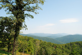 There was still a lot left to Day 60 when I arrived at Shenandoah. So I decided to take a hike up around the campsite.
I walked from my campsite to the trailhead and began my hike. After hiking up a fairly significant hill, I came to a junction. I could go left. I could go right. I didn't remember seeing this junction on the map, so I paused.
Then I looked up and saw a black bear cub (seemed to be more like an adolescent) crossing the path on the left, heading to the right. He was about 50 feet away from me! That may seem like enough, but NPS stresses 150 feet as the safe distance. I made a little noise and the bear looked behind himself. Then my instincts kicked in - I backed away, keeping my eye on him, and returned toward the trailhead. The bear picked his head up and looked right at me.
I got back to camp and was relieved. I've been scared of bears all summer, with the warnings from camp hosts and park rangers. All I really wanted was to encounter a bear when I didn't have access to my car. Seeing that bear that close to me did just that. I am no longer scared of black bears (this doesn't mean I'm any less terrified on grizzly bears).
 The reason I knew what to do was from listening and reading throughout my travels on the various methods to handling bears when you encounter them. For me, even though I hadn't practiced these techniques, simply knowing them transformed them to instincts. I was happy to learn that.
When I returned to camp I told the host of my encounter. She wasn't surprised. She said those bears hang around the camp. She also told me that bear usually hangs around papa bear who is six feet tall! I'm glad I left as soon as I did.
I was a little upset because I wanted a photo of a black bear. I knew it wasn't wise to take one at that distance on foot, but it was disappointing anyways.
About Shenandoah
 There is a road - Blue Ridge Parkway - which runs 467 miles from the southern entrance of Shenandoah National Park in Virginia to the southern entrance of Great Smoky Mountains National Park in North Carolina. Shenandoah essentially extends this parkway another 105 miles as Skyline Drive; and subsequently, the park is built around the road. Also, like the Smokies, people were displaced from their homes for the creation of the park.
Day 61
 My campsite was at the 22-mile mark (22 miles from the northern entrance). Because I didn't want to move camp, I knew I shouldn't drive too far in my day of visiting. So I drove a bit and walked a few trails. I continued to work on waterfall photography and think I did okay. Here's one.
On the way back to camp, I saw a black bear along the side of the road and got a photo. I was so happy to finally get a black bear photo even though I didn't get his face.
Day 62
The next day I got up and planned to drive the remainder of Skyline Drive, connect to Blue Ridge Parkway and drive until I could exit for Blacksburg, Virginia, where a friend of mine attends Virginia Tech.
 I delayed myself a bit in the morning so I could meet my friend when he was available. I sat at my picnic table for a couple hours in the morning, reading and writing. As I was doing so, fog moved in and steadily became thicker. It's funny I call it fog, when what it really is is a cloud. Some of my photos turned out really well. Here's one.
I had read in my bible walking through a foggy forest is a magical experience. I can certainly agree with this. As the fog rolls in, it doesn't matter who is around you. As thick as it was, I couldn't see anything or anyone, and the sound was deadened as well. At one point, I stopped and walked to a meadow. I stood just 20 feet from the drive in this wide open field, yet none of the drivers knew I was there. What a cool experience!
Later that day I reached Blacksburg, but not before I stuck my head into West Virginia. Thus, catching up, Massachusetts was 37; Rhode Island, 38; Connecticut, 39; New Jersey, 40; Delaware, 41; Maryland, 42; Virginia, 43; and West Virginia, 44.
Shenandoah Album
Only two more parks remaining. Stay tuned!
East Coast Cities and Roads
Day 58
From Acadia NP, I really wanted to make it to Cape Cod National Seashore. Unfortunately, time did not permit it. I did drive through (or under) Boston.
This brings me to Big Dig. To anyone I told, "I went in the Big Dig Tunnel," they responded questioningly. The Big Dig was a huge project in Boston. You can read about it if you want. But on I-93 the result is awesome! Going south, it appears as though you are going to run right through the city, and then you drop below it in a 3.5-mile tunnel. When you emerge, that giant skyline that rose before your eyes now sits only in your rear-view mirror.
I ended up staying at a private campground in the southern section of the cape.
Day 59
I have friends who live in New York City and Baltimore. Unfortunately for me, they are real people with real jobs, and based on my time, I was unable to meet them. And as I thought more about it, I realized this really isn't a trip focused on cities. And even more, I didn't want to pay for parking in Manhattan and risk my car (doubling as my home) to be broken into.
I drove through NYC via the GWB (to locals) or the George Washington Bridge. There was enough of a view of Manhattan from the bridge to see how incredibly large it is. I am planning a trip for later this year to fly in and visit for the weekend.
That night I stayed in a state park in New Jersey and I had the same problem I had in New York, but even worse. Here, the permits stopped at 4:00 p.m. Hardly ever are people setting up camp before this time. I justified my squatting by dealing with the massive number of mosquitoes as a result of the flood waters not yet fully receded.
Day 60
On Day 60 I drove through Philadelphia, Baltimore and around Washington. I eventually arrived in Shenandoah National Park later that afternoon.
A Rant on Cities
My drive through these cities got me thinking a little bit about cities and an interview I recently heard with an Australian horror novelist. He was asked if American, English and Australian horror stories are similar or different from each other. He explained those which take place in rural communities or in the wild are completely different because those experiences in those countries are completely different; but those which take place in cities tend to be somewhat similar (assuming the setting is slightly fictionalized).
I have no idea if this is true or not, but it seems logical. And from the outside, many of our cities look the same. Sure, there are differences in demographics and attitudes and wealth, but relatively speaking, they are similar. This is especially true when compared to rural areas of our country. The demographics of our towns differ greatly, I mean greatly, in the different regions of our country. Certainly I haven't visited all of our cities, so I can't speak to what is similar and different, but one day I hope to.
My point in this rant is simply to say I think I made the right decision in sticking to rural areas and not to cities.
A Rant on Roads
While you will soon find I do indeed love some of these eastern parks, you will also find I don't like the roads to get to them (with two large exceptions). The East is very crowded. To make time and not see the same-looking town every couple miles, you need to stick to interstates, and that's just not as fun.
I had to take some state and federal routes in Vermont and I remember coming across a town every five miles or so. Out in the West, you usually have about 30 miles between each town. And, because the towns are smaller, you can drive through them in much less time.
If you take a trip out west, make sure you take state and federal highways whenever you can (outside large city areas, obviously). Well, make sure you get there first. Whether you are driving through North Dakota, South Dakota, Nebraska, Kansas, Oklahoma or Texas, take the interstate.
To have that classic road trip, you really need to be out west. And with that stated, you can read between the lines, into my attitude of the East. Fortunately, though, I kept a positive attitude throughout the trip and looked for beauty and peace in other ways.
From Acadia NP, I really wanted to make it to Cape Cod National Seashore. Unfortunately, time did not permit it. I did drive through (or under) Boston.
This brings me to Big Dig. To anyone I told, "I went in the Big Dig Tunnel," they responded questioningly. The Big Dig was a huge project in Boston. You can read about it if you want. But on I-93 the result is awesome! Going south, it appears as though you are going to run right through the city, and then you drop below it in a 3.5-mile tunnel. When you emerge, that giant skyline that rose before your eyes now sits only in your rear-view mirror.
I ended up staying at a private campground in the southern section of the cape.
Day 59
I have friends who live in New York City and Baltimore. Unfortunately for me, they are real people with real jobs, and based on my time, I was unable to meet them. And as I thought more about it, I realized this really isn't a trip focused on cities. And even more, I didn't want to pay for parking in Manhattan and risk my car (doubling as my home) to be broken into.
I drove through NYC via the GWB (to locals) or the George Washington Bridge. There was enough of a view of Manhattan from the bridge to see how incredibly large it is. I am planning a trip for later this year to fly in and visit for the weekend.
That night I stayed in a state park in New Jersey and I had the same problem I had in New York, but even worse. Here, the permits stopped at 4:00 p.m. Hardly ever are people setting up camp before this time. I justified my squatting by dealing with the massive number of mosquitoes as a result of the flood waters not yet fully receded.
Day 60
On Day 60 I drove through Philadelphia, Baltimore and around Washington. I eventually arrived in Shenandoah National Park later that afternoon.
A Rant on Cities
My drive through these cities got me thinking a little bit about cities and an interview I recently heard with an Australian horror novelist. He was asked if American, English and Australian horror stories are similar or different from each other. He explained those which take place in rural communities or in the wild are completely different because those experiences in those countries are completely different; but those which take place in cities tend to be somewhat similar (assuming the setting is slightly fictionalized).
I have no idea if this is true or not, but it seems logical. And from the outside, many of our cities look the same. Sure, there are differences in demographics and attitudes and wealth, but relatively speaking, they are similar. This is especially true when compared to rural areas of our country. The demographics of our towns differ greatly, I mean greatly, in the different regions of our country. Certainly I haven't visited all of our cities, so I can't speak to what is similar and different, but one day I hope to.
My point in this rant is simply to say I think I made the right decision in sticking to rural areas and not to cities.
A Rant on Roads
While you will soon find I do indeed love some of these eastern parks, you will also find I don't like the roads to get to them (with two large exceptions). The East is very crowded. To make time and not see the same-looking town every couple miles, you need to stick to interstates, and that's just not as fun.
I had to take some state and federal routes in Vermont and I remember coming across a town every five miles or so. Out in the West, you usually have about 30 miles between each town. And, because the towns are smaller, you can drive through them in much less time.
If you take a trip out west, make sure you take state and federal highways whenever you can (outside large city areas, obviously). Well, make sure you get there first. Whether you are driving through North Dakota, South Dakota, Nebraska, Kansas, Oklahoma or Texas, take the interstate.
To have that classic road trip, you really need to be out west. And with that stated, you can read between the lines, into my attitude of the East. Fortunately, though, I kept a positive attitude throughout the trip and looked for beauty and peace in other ways.
Subscribe to:
Posts (Atom)